
Canton Virieu Area 8.45 km² | Intercommunality Vallée de l'Hien | |
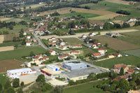 | ||
Doissin is a commune in the department of Isère in southeastern France.
Contents
Map of Doissin, France
Geography
The main villages are: Bouis, Eynoud the Lutheau the Rousset, Trièves and the Marquisière.
Transportation
The nearest airport is GNB - Grenoble Saint Geoirs, located 16.7 km southwest of Doissin. Other airports nearby include LYS - Lyon Saint Exupery 35.8 km northwest, CMF - Chambéry Aix Les Bains 39.3 km north east, LYN - Lyon Bron 44.7 km northwest, NCY - Annecy Meythet 71.4 km northeast,
References
Doissin Wikipedia(Text) CC BY-SA