
Total islands 1 Length 3.7 km (2.3 mi) Area 4.07 km² | Major islands Doini Width 2.5 km (1.55 mi) Adjacent body of water Solomon Sea | |
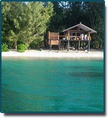 | ||
Doini island plantation resort png
Doini Island (also called Blanchard Island) is an island on the southern side of East Channel, Milne Bay Province, Papua New Guinea.
Contents
- Doini island plantation resort png
- Map of Doini Island Papua New Guinea
- Kiriwina island and doini island
- Administration
- Geography
- Economy
- References
Map of Doini Island, Papua New Guinea
Kiriwina island and doini island
Administration
The island belongs to Logea South Ward, Bwanabwana Rural Local Level Government Area LLG, Samarai-Murua District, which are in Milne Bay Province.
Geography
The island is part of the Doini group, itself a part of Samarai Islands of the Louisiade Archipelago.
Economy
The island is privately owned and is exploited as a holiday resort. The island is served by an airstrip that was built by the resort.
References
Doini Island Wikipedia(Text) CC BY-SA