
Governing body Dept of National Parks Area 482 km² Established 1972 | Phone +66 53 355 728 | |
 | ||
Similar Doi Inthanon, Doi Ang Khang, Wat Phra That Doi Suthep, Phu Chi Fa, Kio Mae Pan | ||
Chiang mai doi inthanon national park thailand
Doi Inthanon National Park (Thai: อุทยานแห่งชาติดอยอินทนนท์), nicknamed "the roof of Thailand", is in the Thanon Thong Chai Range, Chom Thong District, Chiang Mai Province, northern Thailand. It includes Doi Inthanon, the country's highest mountain. Established in 1972, it is 482 square kilometres (186 sq mi) in size.
Contents
Geography
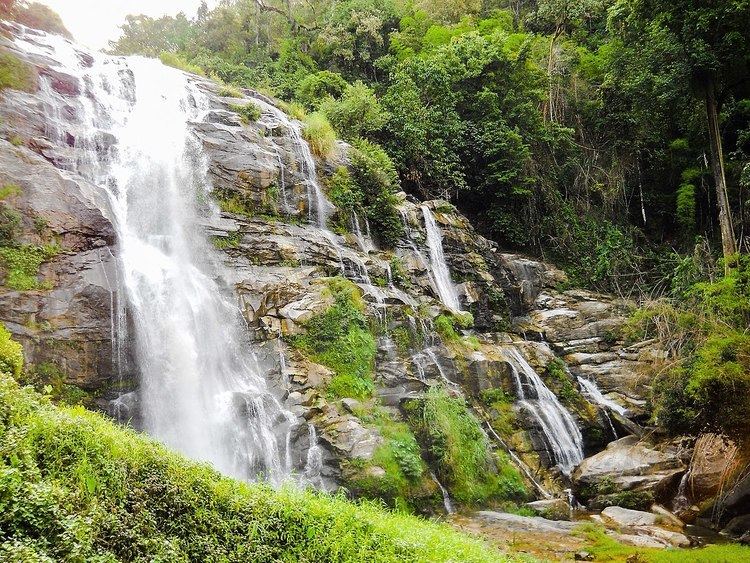
The park is approximately 60 kilometres (37 mi) from Chiang Mai. It includes Karen and Meo Hmong villages of about 4,500 people. Its elevation ranges between 800–2,565 metres (2,625–8,415 ft). Within its borders are a number of waterfalls: Mae Klang Falls, Wachiratan Falls, Siriphum Falls, and Mae Ya Falls. The park has varied climatic and ecologically different sections.
Flora and fauna
Flora includes evergreen cloud forest, sphagnum bog, and deciduous dipterocarp forest. There are some relict pines. With 383 avifauna species, it ranks second among Thailand's national parks in number of bird species.