
Elevation 300 m (1,000 ft) Time zone CET (UTC+1) Area 35.9 km² Postal code 12063 | Demonym(s) Doglianesi Dialing code 0173 Local time Thursday 1:58 PM Dialling code 0173 | |
 | ||
Weather 17°C, Wind S at 8 km/h, 43% Humidity | ||
Dogliani ([doʎˈʎaːni]) is a comune (municipality) in the Province of Cuneo in the Italian region Piedmont, located about 60 kilometres (37 mi) southeast of Turin and about 35 kilometres (22 mi) northeast of Cuneo.
Contents
- Map of 12063 Dogliani Province of Cuneo Italy
- History
- Main sights
- Twin towns Sister cities
- People
- References
Map of 12063 Dogliani, Province of Cuneo, Italy
Dogliani borders the following municipalities: Belvedere Langhe, Bonvicino, Bossolasco, Cissone, Farigliano, Lequio Tanaro, Monchiero, Monforte d'Alba, Roddino, and Somano.
Aside from local craftmanship, the economy is mostly based on agriculture: most of the area is occupied by vines, used for the production of the Dolcetto di Dogliani wine. There are also several woods of common hazels.
Dogliani is also known for its Presepio Vivente. A tradition started in 1975 that occurs yearly on the night of December 23rd and 24th where the town's citizens enact the nativity scene.
History
The town was a settlement of the Ligures, a pre-Roman population. The Roman conquered its area in around 200-100 B.C, although Dogliani is mentioned for the first time in the Middle Ages, as the place of a castle and a borough surrounded by walls along the Rea torrent.
Dogliani was likely a fief of the Aleramici family, and later was osned by the marquisses of Busca, those of Saluzzo and, starting from the early 17th century, by the House of Savoy. In the 19th century Dogliani received numerous new building designed by the eclectic architect Giovanni Battista Schellino.
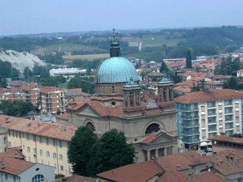
Main sights
Twin towns — Sister cities
Dogliani is twinned with: