Samiksha Jaiswal (Editor)

Doberschau Gaußig

Updated on
Edit
Like
Comment
Share on FacebookTweet on TwitterShare on LinkedInShare on Reddit
Country
  
Germany

District
  
Bautzen

Time zone
  
CET/CEST (UTC+1/+2)

Area
  
40.48 km²

Local time
  
Thursday 7:47 AM

State
  
Saxony

Elevation
  
220 m (720 ft)

Postal codes
  
01877, 02633, 02692

Population
  
4,439 (31 Dec 2008)

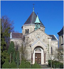
Doberschau-Gaußig httpsuploadwikimediaorgwikipediacommonsthu

Weather
  
6°C, Wind W at 16 km/h, 94% Humidity

Doberschau-Gaußig (Sorbian Dobruša-Huska) is a municipality in the east of Saxony, Germany. It belongs to the district of Bautzen and lies southwest of the eponymous city.

Contents

Map of Doberschau-Gau%C3%9Fig, Germany

Geography

The municipality is situated at the northern edge of the Lausitzer Bergland (Lusatian Hills).

Villages

Several villages belong to the municipality:

  • Arnsdorf (Warnoćicy) - 152 inh.
  • Brösang (Brězynka) - 67 inh.
  • Cossern (Kosarnja) - 91 inh.
  • Diehmen (Demjany) - 229 inh.
  • Doberschau (Dobruša) - 1181 inh.
  • Drauschkowitz (Družkecy) - 68 inh.
  • Dretschen (Drječin) - 113 inh.
  • Gaußig (Huska) - 618 inh.
  • Gnaschwitz (Hnašecy) - 318 inh.
  • Golenz (Holca) - 95 inh.
  • Grubschütz (Hrubjelčicy) - 264 inh.
  • Günthersdorf (Hunćericy) - 109 inh.
  • Katschwitz (Kočica) - 42 inh.
  • Naundorf (Nowa Wjes) - 361 inh.
  • Neu-Diehmen (Nowe Demjany) - 40 inh.
  • Neu-Drauschkowitz (Nowe Družkecy) - 38 inh.
  • Preuschwitz (Přišecy) - 51 inh.
  • Schlungwitz (Słónkecy) - 249 inh.
  • Techritz (Ćěchorjece) - 89 inh.
  • Weißnaußlitz (Běłe Noslicy) - 78 inh.
  • Zockau (Cokow) - 113 inh.
  • References

    Doberschau-Gaußig Wikipedia