
Peak Dział (peak) Country Poland Types of rock Granite, Gneiss | Elevation 678 m (2,224 ft) Area 1,200 km² | |
 | ||
Length 100 km (62 mi) west-east Width 18–20 km (11–12 mi) north-south | ||
The Doły Jasielsko-Sanockie, Latin: Regio Pedemontana German: Sanoker Flachland (Jasielsko–Sanockie Valleys, Jasło and Sanok Valleys, the Jasło-Sanok Basin or Jasielsko-Sanockie Pits) is a mountain range stretching between the Wisłoka and San Rivers in the West Carpathian Plateau and Central Beskidian Piedmont in Poland.
Contents
Geography
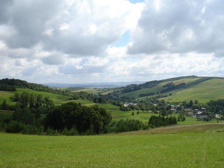
The mountains reach up to 250–500 meters above sea level. The range is situated in the southern part of the Subcarpathian Voivodeship. It is the lowest mountain range of the Polish Carpathians.
They can be divided into: Gorlickie Depression, Jasielskie Plateau, Jasielsko – Krośnieńska Valley and Bukowskie Plateau. They stretch along a 100 km long and 18 km wide strip of land between Low Beskids in the south and heights of plateau in the north.
From the tourist point of view the region of Doły (Pits) is limited from the west by the valley of Ropa River, from the east by the Wisłok and San rivers, from the south by the Low Beskids line and from the north by a Dynowskie Plateau enclosed by the route of the national road No 28 ( from Zator to the national border in Medyka) on the section between Gorlice - Grybów - Biecz - Jasło - Krosno - Rymanów - Sanok. The highest summit on the side is Dział (678 m. high, above the sea level) in the Tabor and Czarny Potok rivers. In general mountains of the Doły are low with gentle slopes and long ridges with a flattened tops and domed summits, and only in some places are characterized by sharp downcasts. The height of summits varies from 350 to 650 m. above the sea level.
Settlement
Important cities of this region include Biecz, Gorlice, Jasło, Krosno, Lesko, Brzozów, Jaćmierz, Rymanów, Brzozów, and Sanok.
History
Historical names for the region include Doły Sanockie (Sanockie Pits) and Podole Sanockie (Sanockie Podolia); it stretches between powiat Krosno, powiat Sanok and Brzozów in Galicia.
In 1854 the first oil field in the world started producing oil in village of Bóbrka near Krosno.
Division
Since there exist many variants of divisions of the mountain ranges and names for the Doły (Pits), several divisions are given in the following: