
Last eruption 1906 | Elevation 4,150 m Parent range Cordillera Central | |
 | ||
Similar Auquihuato, Cerro del Azufre, Andagua volcanic field, Reclus, Carrán‑Los Venados | ||
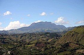
Doña Juana volcano (Spanish: Volcán Doña Juana ) is a stratovolcano located within the Doña Juana-Cascabel Volcanic Complex National Natural Park (Spanish: Parque Nacional Natural Complejo Volcánico Doña Juana-Cascabel) in Nariño Department, Colombia.
Map of Do%C3%B1a Juana, Mocoa, Putumayo, Colombia
With a previous eruption of VEI 4, Doña Juana is rated as a "large" volcano of "cataclysmic" destructive power. During its last eruption, in 1906, more than 100 people were killed and many houses were destroyed.
Its largest known historical eruption was on November 13, 1899. In its prehistory, it is known to have erupted in the 23rd century BC in a caldera-forming eruption of unknown magnitude.
The name of the volcano originated from a legend of the Chincha Indians, within whose native lands it is located: Mama Juana, a beautiful Quiteña, fell in love with Pedro, a commoner, but with the parents opposed to the marriage, they fled, becoming the victims of a curse that turned them into volcanoes.
The volcano can be ascended from a slope that is part of the so-called Valley of Orchids. It is surrounded by an area of extraordinary biodiversity, which includes 471 species of birds (the Andean condor included), bears, deer and pumas.
The summit of Dona Juana consists of a number of peaks, which afford spectacular views, including a view of Laguna del Silencio, one of 42 lakes in the national park