
Country Ukraine Established 23 May 1969 Postal code 02094 Area 66 km² | Municipality Kiev Municipality Time zone EET (UTC+2) Area code +380 44 | |
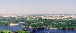 | ||
The Dniprovskyi District (Ukrainian: Дніпровський район, Dniprovs’kyi raion) is an urban district of the city of Kiev (Kyiv), the capital of Ukraine. It is named after the Dnipro River and is located on its left-bank.
Contents
Map of Dniprovs'kyi district, Kiev, Ukraine
Geography
The Dniprovskyi District's area consists of a total of 69 km2 (27 sq mi), which is approximately 16 percent of the city's total area.
History
On 23 May 1969, the Dniprovskyi District was established out of a portion of the city's Darnytskyi District based on a decree of the Presidium of the Verkhovna Rada of the Ukrainian Soviet Socialist Republic.
References
Dniprovskyi District, Kiev Wikipedia(Text) CC BY-SA