
Primary inflows Basin countries Ukraine Average depth 8 m (26 ft) Area 410 km² Mean depth 8 m Outflow location Dnieper | Primary outflows Dnieper River Max. length 129 km (80 mi) Surface elevation 1,676 m Volume 3.3 km³ Length 129 km | |
 | ||
Cities Dnipropetrovsk, Zaporizhia | ||
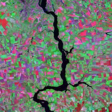
The Dnieper Reservoir (Ukrainian: Дніпровське водосховище, Dniprovs'ke vodoskhovyshche) is a water reservoir on, and named after the Dnieper River in Ukraine. It is located within the Dnipropetrovsk and Zaporizhzhia Oblasts. It was created in 1932 by the construction of the Dnieper Hydroelectric Station.
Map of Dniprovs'ke reservoir, Ukraine
The reservoir is 129 km long, has an average width of 3.2 km (7 km at its widest), and has an average depth of 8 meters (53 m at its deepest). The total water volume is 3.3 km³.
The Lenin Lake, stretching for approximately ten kilometres at the mouth of the Samara River, flows into the northern end of the reservoir. The creation of the reservoir inundated the historic Dnieper Rapids.
References
Dnieper Reservoir Wikipedia(Text) CC BY-SA