Samiksha Jaiswal (Editor)

Division No. 9, Newfoundland and Labrador

Updated on
Edit
Like
Comment
Share on FacebookTweet on TwitterShare on LinkedInShare on Reddit
Country
  
Canada

Population
  
16,786 (2011)

Area
  
13,527 km²

Division No. 9, Newfoundland and Labrador

University
  
College of the North Atlantic St. Anthony

Points of interest
  
Western Brook Pond, Bonne Bay Marine Station, Lobster Cove Head Lighthouse, The Arches Provincial Park, Gros Morne - Newfoundland

Destinations
  
Gros Morne National, Western Brook Pond, L'Anse aux Meadows, Rocky Harbour, St Anthony

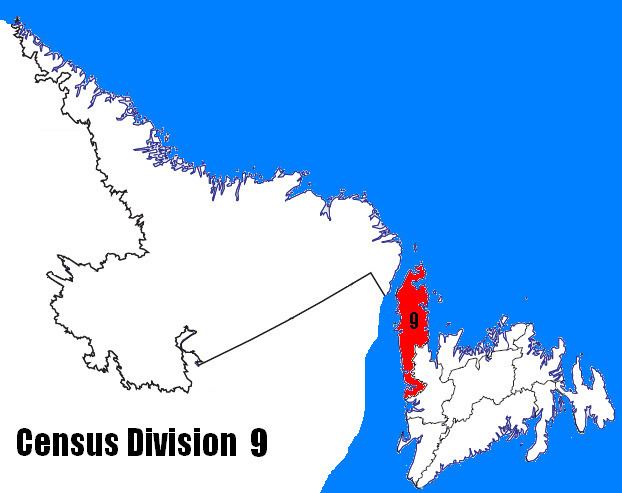
Census Division No. 9 is composed of the area of the province of Newfoundland and Labrador called the Northern Peninsula. It has a land area of 13,526.85 km² (5,222.75 sq mi) and had a population of 16,786 at the 2011 census. The largest community is the town of St. Anthony, near its northern tip, on the Atlantic Ocean coast.

Contents

Map of Division No. 9, NL, Canada

Towns

  • Anchor Point
  • Bellburns
  • Bird Cove
  • Conche
  • Cook's Harbour
  • Cow Head
  • Daniel's Harbour
  • Englee
  • Flower's Cove
  • Glenburnie-Birchy Head-Shoal Brook
  • Goose Cove East
  • Hawke's Bay
  • Main Brook
  • Norris Point
  • Parson's Pond
  • Port au Choix
  • Port Saunders
  • Raleigh
  • River of Ponds
  • Rocky Harbour
  • Roddickton
  • Sally's Cove
  • St. Anthony
  • St. Lunaire-Griquet
  • St. Pauls
  • Trout River
  • Woody Point-Bonne Bay
  • Unorganized subdivisions

  • Subdivision A (Includes: Wiltondale, Lomond, Green Point)
  • Subdivision C (Includes: Plum Point, St. Barbe, Savage Cove)
  • Subdivision D (Includes: Ship Cove, Straitsview, Great Brehat)
  • Subdivision F (Includes: Croque, Williamsport, Grandois)
  • Subdivision G (Includes: Eddies Cove West, Barr'd Harbour)
  • Subdivision H (Includes: Three Mile Rock, Portland Creek, Shallow Bay)
  • References

    Division No. 9, Newfoundland and Labrador Wikipedia