Website www.rockyharbour.ca Area code 709 | Incorporated 1966 Population 979 (2011) Local time Tuesday 3:25 AM | |
 | ||
Weather -3°C, Wind NE at 2 km/h, 82% Humidity | ||
Sea glass and tidal pools rocky harbour newfoundland and labrador by peter bull newfoundland
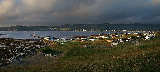
Rocky Harbour is a town located on the western edge of Newfoundland, near the entrance to Bonne Bay. The harbour was previously known as Small Bay or Little Harbour. This town is home to Gros Morne National Park, a World Heritage Site.
Contents
- Sea glass and tidal pools rocky harbour newfoundland and labrador by peter bull newfoundland
- Map of Rocky Harbour NL Canada
- History
- References
Map of Rocky Harbour, NL, Canada
History
Arrowheads show that Micmac Indians once inhabited the area. During the eighteenth and nineteenth centuries, the harbour was frequented by the early French fisherman when it came under the French Shore fishery. The first year Rocky Harbour appeared in the census figures was in 1874, when it had a population of 35.
A Post Office was established there in 1900. It became a Local Government Community in April 1966. Following the opening of Gros Morne National Park in 1973, the population further increased and services such as an RCMP detachment were added. area. It had a population of 357 in 1921. In 2011, the population was 979.
Rocky Harbour is a key tourist town in central Gros Morne National Park, offering nature and scenery viewing, and access to hiking trails. The town's only school, Gros Morne Academy, is also home to the Rocky Harbour public library. Neighbouring communities include Norris Point and Nettie's Harbour. Rocky Harbour has two exits from Newfoundland and Labrador Route 431.
