Population 2,249 (2015 est) Mayor Sherron MacKenzie Founded 1887 | Established 1887 Region Eyre and Western Area 6,232 km² | |
 | ||
Points of interest Murphy's Haystacks, Point Labatt Conserva, Baird Bay Ocean Eco Experience, Streaky Bay National | ||
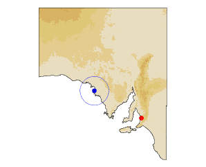
The District Council of Streaky Bay is a local government area in South Australia located on the Eyre Peninsula. Streaky Bay is the main population centre of about 1200 people serving an agricultural district based on farming wheat and other cereal crops, sheep, supplemented by fishing and tourism industries. The district covers an area of 6,251.1 square kilometres with an estimated district population of 2,181 people, according to the Australian Bureau of Statistics.
Contents
- Map of DC of Streaky Bay SA Australia
- District council of streaky bay anzac
- LocalitiesEdit
- Chairmen and mayors of Streaky BayEdit
- References
Map of DC of Streaky Bay, SA, Australia
It was established in 1888 under the District Councils Act 1887. It was, until the creation of the neighbouring District Council of Murat Bay (now Ceduna) in 1925, the farthest outpost of local government in South Australia. While the town of Streaky Bay was named Flinders until 1940, the municipality has been titled Streaky Bay since its inception. In 1936, it was the largest local government area in South Australia, covering 1,614,240 acres.
District council of streaky bay anzac
LocalitiesEdit
The district's focal point is the town of Streaky Bay; it also includes the localities of Baird Bay, Bockelberg, Calca, Chandada, Chilpenunda, Colley, Cungena, Eba Anchorage, Haslam, Inkster, Kaldoonera, Maryvale, Mortana, Mount Cooper, Petina, Perlubie, Piednippie, Poochera, Sceale Bay, Tyringa, Wallalla, Wirrulla, Witera, Yanerbie and Yantanabie, and parts of Carawa, Karcultaby, Koolgera, Pimbaacla and Pureba.
