
Seat 5 Doan Nhu Hai Time zone ICT (UTC+07) | Wards 15 wards Area 4 km² | |
 | ||
Website quan4.hochiminhcity.gov.vn Points of interest Dragon Wharf, Đình Vĩnh Hội, Phố Bích Họa Sài Gòn | ||
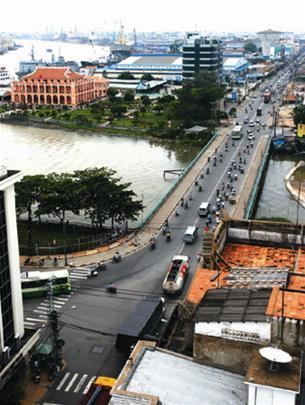
District 4 (Vietnamese: Quận 4) is the smallest urban district (quận) of Ho Chi Minh City, the largest city in Vietnam. The Saigon Port is located here.
Contents
Map of District 4, Ho Chi Minh, Vietnam
As of 2010, the district had a population of 183,261, a total area of 4 km².
Geographical location
District 4 is a triangular cay, surrounded by rivers and canals. It borders Saigon River and District 2 to the northeast, Bến Nghé River and District 1 to the northwest, and Tẻ Canal and District 7 to the south.
There are 15 wards in district 4.
In January 11, 1985, this district consists of five wards, namely: Vĩnh Hội Ward (Which is now divided into four wards numbered from 1 to 4); Lý Nhơn Ward (Which is now divided into three wards numbered 5, 6 and 8); Cây Bàng Ward (Which is now divided into two wards, numbered 9 and 10); Xóm Chiếu Ward (Which is now divided into three wards, numbered 12-14) and Khánh Hội Ward (which is now divided into three wards, numbered 15, 16 and 18).
Times change, these five previously-named wards have their respective divisions which are numbered 1-18 with the exceptions of wards 7, 11 and 17 that makes this district consists of 15 wards.