
Population 2,256 (2011) Civil parish Distington | OS grid reference NY0023 Sovereign state United Kingdom Dialling code 01946 | |
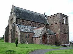 | ||
Distington (/ˈdɪzɪŋtən/) is a large village and civil parish in Cumbria, England, 3 miles (4.8 km) south of Workington and 4 miles (6.4 km) north-northeast of Whitehaven. Historically a part of Cumberland, the civil parish includes the nearby settlements of Common End, Gilgarran and Pica.
Contents
Map of Distington, Workington, UK
The population of the civil parish was recorded as 2,247 in the 2001 Census.
The village has a co-op, a school and a garage.
South of the village by the Lowca Beck are the fragmentary remains of Hayes Castle, a manor house fortified by Robert de Leyburn in 1322.
Governance
An electoral ward in the same name exists. This ward stretches beyond the confines of Distington parish with at total population taken at the Census 2011 of 4,058.
Transport
The main road through Distington is the A595. There was once a railway station at Distington on the Cleator and Workington Junction Railway which was an important junction.
Today Harrington railway station, on the Cumbria Coast Line, is the nearest operational station.