
Country Philippines Founded 1950 Time zone PST (UTC+8) Province Aurora | District Lone District Barangays Area 361.6 km² Local time Wednesday 11:17 AM | |
 | ||
Region Central Luzon (Region III) Weather 26°C, Wind N at 8 km/h, 84% Humidity Points of interest Dipaculao Beach, Baler Beach, Disagadan Beach, Bungan Beach Neighborhoods Buenavista, Lipit, Ipil, Debutunan, Debutunan Pt | ||
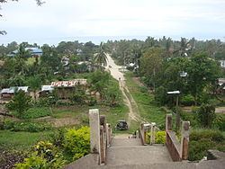
Dipaculao, officially the Municipality of Dipaculao (Filipino: Bayan ng Dipaculao; Ilocano: Ili ti Dipaculao), is a municipality in the province of Aurora in the Central Luzon (Region III) of the Philippines. The population was 29,736 at the 2015 census. In the 2016 electoral roll, it had 17,722 registered voters.
Contents
Map of Dipaculao, Aurora, Philippines
The municipality is home to the Dinadiawan River Protected Landscape.
History
On June 21, 1957 the sitios of Dimabono, Laboy, Dinadiawan and Puangi were converted into barrios. Several more sitios were converted into barrios on June 18, 1966.
Geography
Dipaculao is located at 15°59′N 121°38′E.
According to the Philippine Statistics Authority, the municipality has a land area of 361.64 square kilometres (139.63 sq mi) constituting 7001114900000000000♠11.49% of the 3,147.32-square-kilometre- (1,215.19 sq mi) total area of Aurora.
Barangays
Dipaculao is politically subdivided into 25 barangays.
Demographics
In the 2015 census, Dipaculao had a population of 29,736. The population density was 82 inhabitants per square kilometre (210/sq mi).
In the 2016 electoral roll, it had 17,722 registered voters.