
Topo map USGS Diamond Peak Elevation 2,665 m | Prominence 946 m Easiest route Hiking | |
 | ||
Age of rock less than 100,000 years Last eruption more than ~11,000 years ago First ascent 1852 John Diamond & William Macy Similar Mount Thielsen, Maiden Peak, Mount Bailey, Yamsay Mountain, Mount McLoughlin | ||
Diamond Peak is a shield volcano in southwest Oregon and is part of the Cascade Range. The mountain is located near Willamette Pass in the Diamond Peak Wilderness within the Willamette National Forest.
Contents
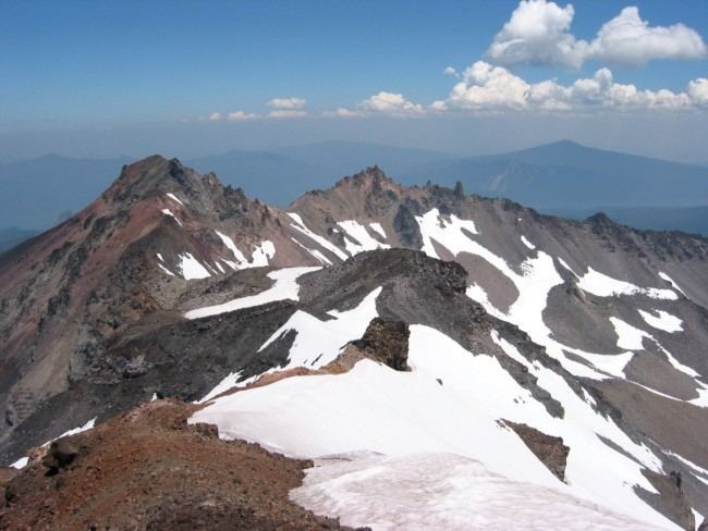
Map of Diamond Peak, Oregon, USA
Composed of 15 cubic kilometres (3.6 cu mi) of basaltic andesite, the volcano is older than the last ice age but probably younger than 100,000 years. It first began erupting from its northern summit and then from a new vent a little to the south, which is now the primary peak. The mountain has several cirques from glacial erosion. It lies directly on the Cascade Crest and therefore receives a heavy snow pack. Snow fields on the northern side may have been glaciers as recently as 100 years ago.
HistoryEdit
William Macy and John Diamond climbed Diamond Peak in July 1852. These two men were part of a preliminary survey party known as the "Road Viewers." They climbed the peak in order to plan a road that later became known as the Free Emigrant Road. They named the peak for Diamond, who was a pioneer from Eugene. The road was completed in late September 1853, only days before some 1,027 people with 250 wagons arrived at the Deschutes River at what is now Bend. These emigrants, known as the "Lost Wagon Train of 1853," were following Elijah Elliott through the central Oregon high desert on what became known as the Elliott Cutoff. It took time to locate the road because it was 30 miles (48 km) upstream on the Deschutes. The road led them to Emigrant Pass by Summit Lake and then down the western side of the pass. In mid-October the emigrants were discovered on the Middle Fork Willamette River by the settlers of the upper Willamette Valley and a large rescue operation was launched to help the emigrants reach the settlements. This emigration doubled the population of Lane County.