
- summer (DST) CEST (UTC+2) Elevation 115 m | Area 26.28 km² Local time Monday 10:12 PM | |
 | ||
Weather 3°C, Wind SE at 6 km/h, 81% Humidity | ||
Diakovce (Hungarian: Deáki) is an old village and municipality in Šaľa District, in the Nitra Region of southwest Slovakia.
Contents
Map of Diakovce, Slovakia
Geography
The village lies at an altitude of 118 metres and covers an area of 26.28 km².
History
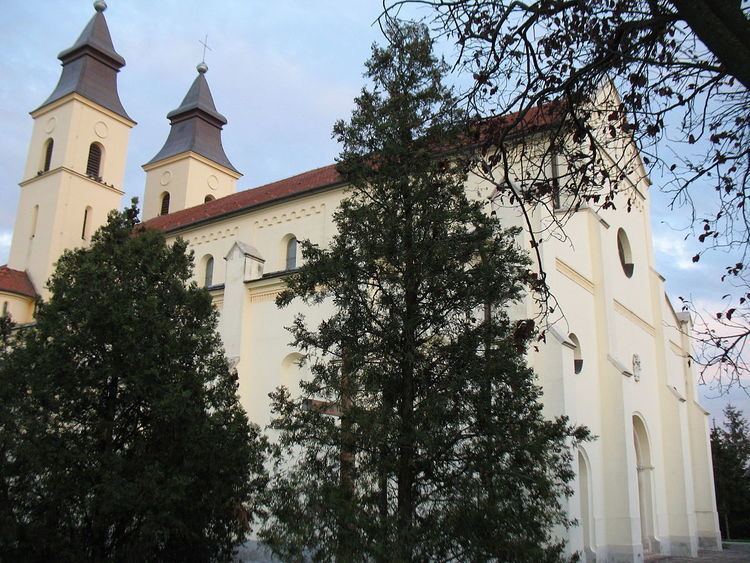
In historical records the village was first mentioned in 1002 meaning that it is one of the oldest recorded villages in Slovakia. In 1001, Stephen I of Hungary deployed Benedictines here. From that time, the area was the property of the abbey of Pannonhalma. In 1228 a twin-towered Romanesque cathedral, the oldest monument in Slovakia, ever built.
After the Austro-Hungarian army disintegrated in November 1918, Czechoslovak troops occupied the area, later acknowledged internationally by the Treaty of Trianon. Between 1938 and 1945 Diakovce once more became part of Miklós Horthy's Hungary through the First Vienna Award. From 1945 until the Velvet Divorce, it was part of Czechoslovakia. Since then it has been part of Slovakia.
Population
It has a population of about 2235 people. The village is about 72% Magyar and 28% Slovak.
Facilities
The village has a public library, a gym a swimming pool and a football pitch.