
Country Language spoken Area 3,034 km2 | State Founded Dhaval Dev in 11th century | |
Dholpur is a city in eastern-most parts of the Rajasthan state of India. It is the administrative headquarters of Dholpur District and was formerly seat of the Dholpur princely state, before Independence.
Contents
- Map of Dholpur
- Zdm5 dholpur bari tantpur narrow gauge
- Zdm5 sirmuttra dholpur tantpur narrow gauge
- Geography
- History
- Tourism and landmarks
- Economy
- 1st ac food indias fastest train bhopal shatabdi
- References
Map of Dholpur
Dhaulpur became a separate district in 1982 comprising four tehsils of Bharatpur: Dholpur, Rajakhera, Bari and Baseri. It is bordered by Bharatpur district of Rajasthan and Uttar Pradesh to the north, Madhya Pradesh to the south, Karauli district to the west and Uttar Pradesh and Madhya Pradesh to the east.
Zdm5 dholpur bari tantpur narrow gauge
Zdm5 sirmuttra dholpur tantpur narrow gauge
Geography
The geographical coordinates for Dholpur (Dhaulpur) are 26° 42 0" North, 77° 54 0" East. Total area of Dholpur district is 3,034 sq. kilometers.
History
During Buddha’s time there were sixteen Mahajanapadas in Bharatvarsh. Dholpur at that time was included in Matsya Janpad. During the Mauryan rule it was included in the Mauryan Empire. From Gupta period to the arrival of Chinese traveler Huansuang Bharatpur, Karauli and Dholpur were a part of Mathura Janpad. Around the 8th to 10th centuries, Chauhans ruled over it. In the year 1194 it remained under Mohammed Gauri.
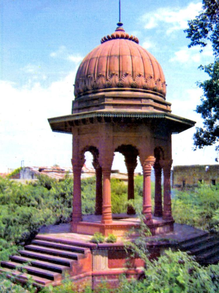
Tourism and landmarks
The prime tourist attractions in Dholpur are:
Economy
The economy of Dhaulpur is primarily agricultural. Dholpur sandstone is mined in the area, which is simply called "Dholpur", and was used in the construction of Rashtrapati Bhavan and Secretariat Building, New Delhi in the 1920s. A gas-based thermal power plant of 330 Megawatt capacity has started working in Dholpur.