
 | ||
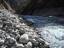
The Dhauliganga is one of the six source streams of the Ganges river. It meets the Alaknanda River at Vishnuprayag at the base of Joshimath mountain in Uttarakhand.
Contents
Map of Dhauliganga River, Uttarakhand
Path
The 82 km (51 mi)-long Dhauliganga rises at an altitude of 5,070 m (16,630 ft) in the Niti Pass in Chamoli District of Uttarakhand. At Raini, 25 km (16 mi) from Joshimath, it is joined by the Rishi Ganga river. The Dhauliganga ends at Vishnuprayag, when it runs into the Alaknanda River. Tapovan, known for its hot sulfur springs, is situated on the banks of the river.
References
Dhauliganga River Wikipedia(Text) CC BY-SA