
Time zone IST (UTC+05:30) Elevation 0 cm Area code +04567 | Destroyed 1964 Telephone code +04567 Local time Monday 10:36 PM | |
 | ||
Weather 29°C, Wind S at 21 km/h, 80% Humidity Points of interest Old Dhanushkodi Railway Station, Dilapidated Church, Sangamam, Kamal Gaur beach | ||
Rameswaram dhanushkodi tourist places in india ghost town tamil nadu tourism
Dhanushkodi is an abandoned town at the south-eastern tip of Pamban Island of the state of Tamil Nadu in India. It is situated to the South-East of Pamban and is about 18 miles (29 km) west of Talaimannar in Sri Lanka. The town was destroyed during the 1964 Rameswaram cyclone and remains uninhabited in the aftermath.
Contents
- Rameswaram dhanushkodi tourist places in india ghost town tamil nadu tourism
- Map of Dhanushkodi Tamil Nadu
- Tourist places in india ghost town dhanushkodi rameshwaram
- History
- 1964 cyclone
- Geography
- Transport
- References
Map of Dhanushkodi, Tamil Nadu
Tourist places in india ghost town dhanushkodi rameshwaram
History
According to the Hindu epic Ramayana, Lord Rama built a bridge to connect India and Sri Lanka, in order to carry his troops. Rama marked the spot for the bridge with one end of his bow which later became Dhanushkodi meaning end of the bow.
1964 cyclone
The area around Rameswaram is prone to high-intensity cyclones and storms. A scientific study conducted by the Geological Survey of India indicated that the southern part of Dhanushkodi facing the Gulf of Mannar sank by almost 5 metres (16 ft) in 1948 and 1949, due to vertical tectonic movement of land parallel to the coastline. As a result of this, a patch of land of about 0.5 kilometres (0.31 mi) in width, stretching 7 kilometres (4.3 mi) from north to south, submerged in the sea.
On 17 December 1964, a depression formed at 5°N 93°E in the South Andaman Sea. On 19 December, it intensified into a cyclonic storm. After 21 December 1964, it moved westwards, almost in a straight line, at the rate of 400 to 550 kilometres (250 to 340 mi) per day. On 22 December, it crossed Vavunia in Sri Lanka and made landfall at Dhanushkodi on the night of 22–23 December 1964. Estimated wind velocity was 280 kilometres per hour (170 mph) and tidal waves were 7 metres (23 ft) high.
An estimated 1,800 people died in the cyclonic storm on 22 December including 115 passengers on board the Pamban-Dhanushkodi passenger train. The entire town was marooned and the Government of Madras declared Dhanushkodi as Ghost town, unfit for living.
In December 2004, the sea around Dhanushkodi receded about 500 metres (1,600 ft) from the coastline, exposing the submerged part of the town for a while followed by massive tsunami waves that struck the coast.
Geography
Dhanushkodi is located on the tip of Pamban island separated by mainland by Palk strait. It shares the only land border between India and Sri Lanka, which is one of the smallest in the world at 45 metres (148 ft) in length on a shoal in Palk Strait.
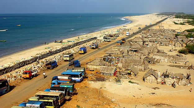
Transport
A metre gauge railway line connected Mandapam on mainland India to Dhanushkodi. Boat mail express ran from Chennai Egmore to Dhanushkodi till 1964 when the metre-gauge branch line from Pamban to Dhanushkodi was destroyed during the 1964 Dhanushkodi cyclone. In 2003, Southern Railway sent a project report to Ministry of Railways for re-laying a 16 kilometres (9.9 mi) railway line to Dhanushkodi from Rameswaram. The planning commission looked into the possibility of a new railway line between Dhanushkodi and Rameswaram in 2010. Until 2016, Dhanushkodi was reachable either on foot along the seashore or in jeeps. In 2016, a road was completed from the village of Mukundarayar Chathiram.