
Location Dhamni Type of dam Earthfill Length 1,563 m (5,128 ft) Surface area 16,130 km² | Opening date 1990 Impounds Surya river Height 59 m | |
 | ||
Official name Dhamni (Surya) Dam D02997 People also search for Surya Dam, Bhatsa Dam, Modak Sagar | ||
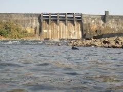
Dhamni dam water level high
Dhamni (Surya) Dam, is an earthfill dam on Surya River near Dhamni, Thane district in the state of Maharashtra in India.
Contents
- Dhamni dam water level high
- Map of Dhamni Dam Kunj Maharashtra 401607
- Kolhapur dhamni dam issue
- Specifications
- Purpose
- References
Map of Dhamni Dam, Kunj, Maharashtra 401607
Kolhapur dhamni dam issue
Specifications
The height of the dam above lowest foundation is 59 m (194 ft) while the length is 1,563 m (5,128 ft). The volume content is 1,270 km3 (300 cu mi) and gross storage capacity is 285,310.00 km3 (68,449.51 cu mi).
Purpose
Surya Hydroelectric Project was commissioned in 1999 by Government of Maharashtra and then Handed over to MAHAGENCO (then MSEB) in May 2002. The plant's capacity is 6 MW, generated by one Vertical shaft Kaplan turbine, manufactured by BHEL.
References
Dhamni Dam Wikipedia(Text) CC BY-SA