
Location Lake District, Cumbria Basin countries United Kingdom Primary outflow Blackbeck | Primary outflows Black Beck Surface elevation 236 m Parent range Lake District | |
 | ||
Devoke Water is a small lake in the mid-west region of the English Lake District, in the county of Cumbria. It is the largest tarn in the Lake District.
Contents
Map of Devoke Water, Broughton-in-Furness, UK
It lies on Birker Fell, 1 km to the west of the road between Ulpha and Eskdale, at an altitude of 770 feet (223 m). It has a depth of 46 ft (14 m).
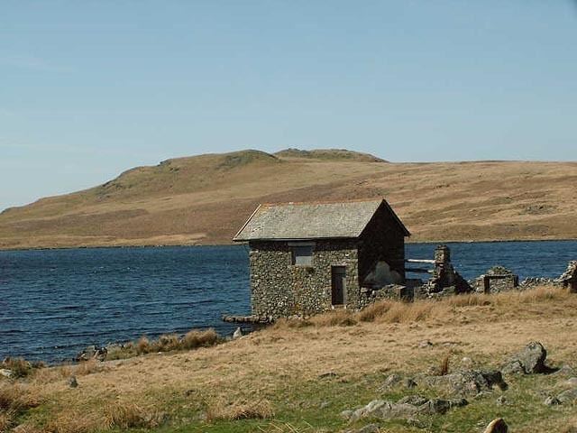
It can be reached via a bridle track. There is a two-storey stone boathouse-cum-refuge and a ruined stable.
Devoke Water has an outlet in the north west, via Black Beck, which, after a short distance, plunges over rocks down a 26 ft (8 m) cascade, towards the River Esk.
The fishing rights to Devoke Water are owned by Millom Anglers and it is stocked with brown trout. It also holds perch.
The Circuit of Devoke WaterEdit
One of the chapters of Alfred Wainwright's The Outlying Fells of Lakeland is a circular walk anticlockwise around Devoke Water, starting and finishing on the road to the east. He describes the summits Rough Crag at 1,049 feet (320 m), Water Crag at 997 feet (304 m), White Pike at 1,370 feet (420 m), Yoadcastle at 1,610 feet (490 m), Woodend Height at 1,597 feet (487 m) and Seat How at 1,020 feet (310 m), and notes that White Pike has a "splendid columnar cairn" and a view to Muncaster Castle.