
Website www.derventa.ba Local time Tuesday 6:46 AM Team FK Tekstilac Derventa | Time zone CET (UTC+1) Area 517 km² Area code 53 | |
 | ||
Weather 7°C, Wind NE at 18 km/h, 87% Humidity | ||
Bosnian road m 19 02 han derventa village romanija saddle podromanija village
Derventa (Serbian Cyrillic: Дервента) is a town and municipality just northwest of the town of Doboj, in the Posavina region. The municipality comprises 57 villages as well as the town itself. Derventa is a part of the Republika Srpska entity in Bosnia and Herzegovina.
Contents
- Bosnian road m 19 02 han derventa village romanija saddle podromanija village
- Map of Derventa Bosnia and Herzegovina
- Bosnian road m 5 02 han derventa village pale town
- Geography
- Settlements
- History
- Demographics
- Current population
- Sports
- References
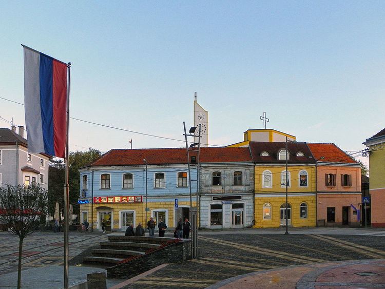
Map of Derventa, Bosnia and Herzegovina
Bosnian road m 5 02 han derventa village pale town
Geography
The Derventa municipality borders with Brod, Modriča, Doboj, Prnjavor and Srbac, as well as Croatia across the Sava river. It has an area of 517 km2 (200 sq mi) and includes 57 villages in addition to the actual town of Derventa.
The town of Derventa lies on the river Ukrina, and roads lead from it to Bosanski Brod, Kotorsko (Doboj), Prnjavor (Banja Luka) and Srbac.
The town has a suburb called Derventski Lug which has grown substantially in recent years due to growth of Municipality.
Settlements
• Agići • Begluci • Bijelo Brdo • Bosanski Dubočac • Brezici • Bukovac • Bukovica Mala • Bukovica Velika • Bunar • Cerani • Crnča • Dažnica • Derventa • Donja Bišnja • Donja Lupljanica • Donji Detlak • Donji Višnjik • Drijen • Gornja Bišnja • Gornja Lupljanica • Gornji Božinci • Gornji Detlak • Gornji Višnjik • Gradac • Gradina • Kalenderovci Donji • Kalenderovci Gornji • Kostreš • Kovačevci • Kulina • Kuljenovci • Derventski Lug • Lužani • Lužani Bosanski • Lužani Novi • Mala Sočanica • Mišinci • Miškovci • Modran • Osinja • Osojci • Pjevalovac • Pojezna • Poljari • Polje • Rapćani • Stanići • Šušnjari • Tetima • Trstenci • Tunjestala • Velika • Velika Sočanica • Vrhovi • Zelenike • Žeravac i Živinice.
History
From 1929 to 1939, Derventa was part of the Vrbas Banovina and from 1939 to 1941 of the Banovina of Croatia within the Kingdom of Yugoslavia.
Demographics
Derventa's population is split into two different categories. The first being a demographic of the town's population solely. The second however also takes into account the town's population, but it also includes all of the other settlements as well. The previous censuses were taken during the period of SFR Yugoslavia, prior to the 1992-95 War, which would engulf the region. Like many other areas in the country the war drastically changed the composition of Derventa's population.
Current population
The most recent census in the country was carried out between October 1st and October 15th, 2013. It was the first census in the country since the Bosnian War. The full ethnic statistics will not be released until an as yet (as of July 2015) undetermined date. Preliminary results estimate the municipality's population to be 30,177.
Sports
The most popular sport in Derventa is football and the city has a long footballing tradition. Derventa's first football club was formed in 1919 under the name FK Dečko. Several other sports associations formed in Derventa prior to the outbreak of the Second World War. The war caused the dissolution of all previous clubs in Derventa and the formation of FK Tekstilac, who merged with FK Dečko. FK Tekstilac still competes today in the First League of the Republika Srpska and its home ground is Gradski Stadion FK Tekstilac, which has an attendance capacity of around 500 spectators. Derventa's most successful sports team is RK Derventa, which currently competes in the Premier league of Bosnia and Herzegovina for handball, which is the nation's top professional handball division. Derventa is known throughout the region for its tradition of handball excellence, creating many great players as well as having a very successful club given that it is such a small city.