
Population 666 (2006 census) Postal code 3352 | Postcode(s) 3352 State electorate(s) Polwarth Elevation 348 m | |
 | ||
Location 133 km (83 mi) W of Melbourne33 km (21 mi) S of Ballarat70 km (43 mi) N of Colac32 km (20 mi) N of Cressy Federal divisions Division of Ballarat, Division of Corangamite | ||
Dereel is a town in the Western District of the Australian state of Victoria. At the 2006 census, Dereel and the surrounding area had a population of 666.
Map of Dereel VIC 3352, Australia
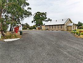
It is located on the Ballarat-Colac Road, 33 kilometres (21 mi) from Ballarat and 70 kilometres (43 mi) from Colac. There is no clearly defined town centre, though the Dereel Soldiers' Memorial Hall, located on Swamp Road, is commonly considered as the town centre.
Dereel Post Office opened on 1 November 1868 and closed in 1971.
Dereel includes a large wetlands area, referred to as the "Swamp" or "Lagoon". In recent years it is almost dry.
On 27 March 2013, a bushfire at Dereel destroyed 16 houses and 18 sheds. The fire covered 1,300 hectares (3,212 acres).
References
Dereel, Victoria Wikipedia(Text) CC BY-SA