
Population 122 (2006 census) Local time Saturday 1:15 AM | Postcode(s) 3322 Postal code 3322 | |
 | ||
Location 140 km (87 mi) W of Melbourne63 km (39 mi) S of Ballarat39 km (24 mi) N of Colac20 km (12 mi) N of Beeac Cressy Barunah PlainsBarunah Park Weather 17°C, Wind E at 18 km/h, 89% Humidity Federal divisions Division of Corangamite, Division of Wannon | ||
Cressy is a country town in Victoria, Australia, about 38 km north of Colac on the Ballarat road. It is divided between Golden Plains Shire, the Shire of Colac Otway and Corangamite Shire. At the 2006 census, Cressy and the surrounding area had a population of 122.
Contents
Map of Cressy VIC 3322, Australia
History
George Russell, manager of the pastoral Clyde Company, opened up the area to European settlement in 1836. In 1837, a Frenchman named Jean Duverney crossed the Woady Yaloak River, claimed land on both banks, and named the area "Frenchman's Run". Duverney called the small, developing village Cressy, after Crécy in France, where he was born.
Cressy Post Office opened on 1 January 1858.
After the outbreak of World War II, an airfield was constructed south of the town towards Colac, and was used by the RAAF until 1946 as a combat training base and for bombing practice. Cressy airfield had three airstrips, two about 300 metres long with a drained gravel surface and a grass airstrip about 400 metres long. Two large Bellman hangars were used for aircraft maintenance. The local history group at the church has some photos and information on the airmen and the planes involved. Several RAAF aircraft crashed in the vicinity during the war.
The tranquil local cemetery, surrounded by old trees, is still in use.
Railways
The first railway to reach Cressy was an extension of the line from Colac to Beeac. This opened in December 1910, and by September 1911, the line had been extended north to Newtown, where it joined the line to Ballarat. In September 1910 work began at Cressy on the Western Plains Railway. This line ran joined the line to Ararat at Maroona, and the lines to Geelong at Gheringhap. Cressy, being at the junction of these lines, became an important railway centre, with extensive buildings, railway yards and a turntable. Buildings included station offices, refreshment rooms and an elevated signal box. This line was closed in 1953. Very few traces of Cressy station now remain.
Cressy in recent times
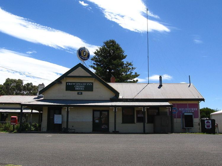
Cressy was once a bustling town with several shops, garages, churches and a thriving railway station. Cressy still boasts many interesting old buildings, although many were destroyed in the fires of 1977 which also killed three people. There are two beautiful old churches, and the Cressy Historical Society is now housed in the Presbyterian Church, opposite the old Post Office and general store. The church was built in 1862 and is open for research on the first Sunday of every month. The old post office and telephone exchange was built in 1924 at a cost of £5,000. After it was closed it was turned into a family home. It has now opened as a cafe and mixed business. The public restrooms back onto a picnic spot with a new children's playground.