
Country Macedonia Time zone CET (UTC+1) Climate Cfb Population 2,593 (2002) Area code +389 | Car plates BT Area 480.1 km² Local time Monday 8:08 AM | |
 | ||
Weather 8°C, Wind S at 14 km/h, 83% Humidity | ||
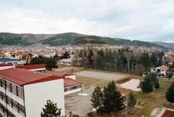
Demir Hisar (Macedonian: Демир Хисар [dɛˈmir‿xisar]) (formerly Murgaševo) is a town in Republic of Macedonia. It is the seat of Demir Hisar Municipality. This small settlement has an absolute Macedonian ethnic majority. The name of the town translates to "Iron Castle" in Turkish, and dates back to the time when Macedonia was ruled by the Ottoman Empire.
Contents
Map of Demir Hisar, Macedonia (FYROM)
The settlement is situated along the main road between the important Macedonian cities of Bitola and Kičevo.
Demographics
The town of Demir Hisar has 2,593 residents.
References
Demir Hisar (town) Wikipedia(Text) CC BY-SA