
North end: OR 569 in Eugene Length 2.6 km County Lane County, Oregon | Counties: Lane Constructed 27 October 1964 | |
 | ||
Existed: October 27, 1964 – present South end: I-105 / OR 126 in Eugene Similar Bear Camp Road, Cornelius Pass Road, Rose City Freeway | ||
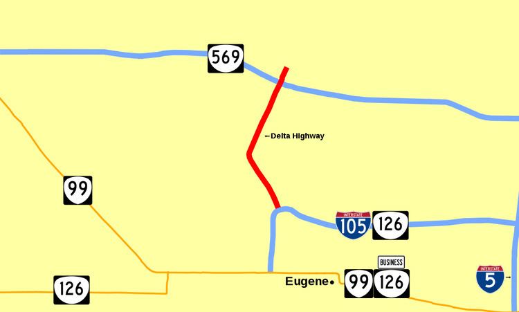
Delta Highway is a short limited-access freeway in Eugene, Oregon, United States, linking downtown Eugene with Beltline Highway, northern Eugene, and the Riverridge golf course to the north.
Contents
Map of Delta Hwy, Eugene, OR 97401, USA
Route description
Delta Highway begins at an interchange with Interstate 105 near downtown Eugene. Heading north from the interchange, it passes a shopping mall and a few car dealerships before crossing through a wetland area called the Delta Ponds. The freeway ends at Beltline Highway, but continues as a two-lane surface street named the N. Delta Highway northward to Ayres Road and the Riverridge golf course.
Aside from the two interchanges with the city's major highways, Delta Highway has only two exits. The first exit provides the primary access for the Valley River Center shopping mall. The second exit leads to other commercial and residential areas in the Goodpasture Island neighborhood.
The interchange at Beltline Highway is planned to be upgraded along with several enhancements to the rest of Beltline Highway.
History
Delta Highway opened on October 27, 1964.
Exit list
The entire route is in Eugene, Lane County. All exits are unnumbered.