
Country United States FIPS code 36-20104 Elevation 400 m Population 2,670 (2010) | State New York Time zone Eastern (EST) (UTC-5) GNIS feature ID 0978894 Local time Sunday 6:53 PM | |
 | ||
Weather -6°C, Wind N at 10 km/h, 24% Humidity Area 91.43 km² (89.87 km² Land / 155 ha Water) | ||
Delaware is a town in Sullivan County, New York, USA. The population was 2,670 at the 2010 census.
Contents
Map of Delaware, NY, USA
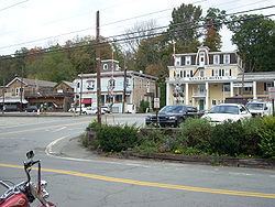
The Town of Delaware is in the western part of the county.
History
The town was formed in 1869 from the Town of Cochecton.
Geography
The west town line, delineated by the Delaware River, is the border of Wayne County, Pennsylvania.
According to the United States Census Bureau, the town has a total area of 35.3 square miles (91 km2), of which, 34.7 square miles (90 km2) of it is land and 0.6 square miles (1.6 km2) of it (1.67%) is water.
Demographics
As of the census of 2000, there were 2,719 people, 956 households, and 657 families residing in the town. The population density was 78.3 people per square mile (30.2/km²). There were 1,337 housing units at an average density of 38.5 per square mile (14.9/km²). The racial makeup of the town was 87.31% White, 9.71% African American, 0.22% Native American, 0.81% Asian, 0.04% Pacific Islander, 0.99% from other races, and 0.92% from two or more races. Hispanic or Latino of any race were 6.33% of the population.
There were 956 households out of which 28.3% had children under the age of 18 living with them, 55.6% were married couples living together, 10.0% had a female householder with no husband present, and 31.2% were non-families. 26.3% of all households were made up of individuals and 10.6% had someone living alone who was 65 years of age or older. The average household size was 2.44 and the average family size was 2.93.
In the town, the population was spread out with 26.8% under the age of 18, 12.7% from 18 to 24, 23.1% from 25 to 44, 23.2% from 45 to 64, and 14.3% who were 65 years of age or older. The median age was 36 years. For every 100 females there were 101.6 males. For every 100 females age 18 and over, there were 100.6 males.
The median income for a household in the town was $40,145, and the median income for a family was $45,875. Males had a median income of $37,700 versus $22,885 for females. The per capita income for the town was $17,884. About 6.2% of families and 20.0% of the population were below the poverty line, including 15.2% of those under age 18 and 6.1% of those age 65 or over.