
Demonym(s) Delanonians Area code 316 | Elevation 396 m | |
 | ||
Platted 18?? (Elgin)1871 (Delano)1880 (West Wichita) Restaurants T J's Burger House, Delano Barbeque Company, Taco Rio, Yokohama Ramen Joint, Wichita Fish Co | ||
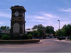
Delano is a neighborhood in Wichita, Kansas, United States. A mixed commercial and residential area on the west bank of the Arkansas River, it is home to Friends University, Lawrence–Dumont Stadium, and Exploration Place, the Sedgwick County science museum.
Contents
- Map of Delano Wichita KS USA
- History
- Geography
- Government
- Primary and secondary education
- Colleges and universities
- Parks and recreation
- Points of interest
- References
Map of Delano, Wichita, KS, USA
History
Thanks to the availability of cheap land under the Homestead Act of 1862, settlers purchased land across the Arkansas River from Wichita, Kansas. These settlers named their new community Elgin. In 1870, Elgin became a cattle shipment point on the Chisholm Trail and began to grow. In March 1871, local residents renamed the town Delano after Columbus Delano, Secretary of the Interior under President Ulysses S. Grant. Hotels, saloons, and other new businesses opened over the next two years along with a post office and a toll bridge across the river to Wichita. Unlike Wichita, Delano had no law enforcement. As a result, it became an area center of drinking, gambling, and prostitution for cowboys working in the cattle trade. Gunfights occurred as well, including a fatal and locally famous incident between two saloon keepers in 1873. In the late 1870s, the cattle trade relocated west to Dodge City, and Delano’s period as a rowdy cowtown came to a close.
Wichita annexed Delano in 1880, and it became locally known as West Wichita. An economic boom a few years later triggered residential development. Streets in the neighborhood were named after prominent settlers. New businesses opened as well, including a watch factory. Garfield University, later renamed Friends University, opened in Delano in 1887. By the end of the decade, however, the city had entered an economic recession, and many locals went bankrupt.
Development returned in the early 1900s with renewed growth in manufacturing and the oil industry. In the 1920s, Wichita became a center of aircraft manufacturing, and several companies opened facilities in Delano. These included Travel Air moving to Delano in 1925 from 471 W. First, Cessna in 1927 at 1520 W. Douglas as well as smaller companies like the Wichita Blue Streak Motor Company, Hilton Aircraft, and Yunker Aircraft Corporation.
In the early 1930s, the Ackerman Island sandbar located in the middle of the Arkansas River was moved westward to become the west bank of the current river. The former baseball stadium on Ackerman Island was razed, so a new baseball field was built, Lawrence Athletic Field, later Lawrence–Dumont Stadium, opened in Delano in 1934. That same year, the city government had the Ben F. McLean Memorial Fountain built in the neighborhood to commemorate McLean a former mayor.
In the 1950s and 60s, businesses and retailers began to leave the neighborhood. The aircraft industry relocated elsewhere in the city. The majority of Delano was modest residential property, built in the first three decades of the 20th century. It is quintessential West Side Wichita, as demonstrated in Delano Stories from the Neighborhood. By the 1990s, the area had entered a period of modest decline. In 1999 and 2000, neighborhood organizations and the city government collaborated to develop and implement a revitalization plan, including infrastructure investment and new business development. Since, Delano’s business district has become a local shopping and entertainment area marketed as the Historic Delano District.
Geography
Delano is located at 37°40′58″N 97°21′35″W (37.682778, -97.359722) at an elevation of 1,299 feet (396 m). The Arkansas River forms its northern and eastern boundary, U.S. Route 54 its southern boundary, and Meridian Avenue its western boundary. Located across the river west from Downtown Wichita, Delano borders the neighborhoods of McCormick to the south and Sunflower to the west. Riverside lies across the river to the north.
Government
For the purposes of representation on the Wichita City Council, Delano is split between Districts 4 (southwest Wichita) in the south half and 6 (near northwest Wichita) in the north
For the purposes of representation in the Kansas Legislature, Delano is located in the 25th district of the Kansas Senate and the 95th district of the Kansas House of Representatives.
Primary and secondary education
Wichita Public Schools operates two facilities in Delano: Allison Traditional Magnet Middle School and Franklin Elementary School.
The Roman Catholic Diocese of Wichita oversees one Catholic elementary school in the neighborhood, St. Joseph School.
Colleges and universities
Friends University, a private, non-denominational Christian university, is located in Delano.