
Surface area 12 km (4.6 sq mi) Surface elevation 1,651 m Catchment area 1,870 km² | Primary inflows Basin countries United States Max. depth 42 m (138 ft) Area 12 km² Outflow location Provo River | |
 | ||
Similar Heber Valley Historic R, Wasatch Range, Mount Timpanogos, Soldier Hollow, Starvation State Park | ||
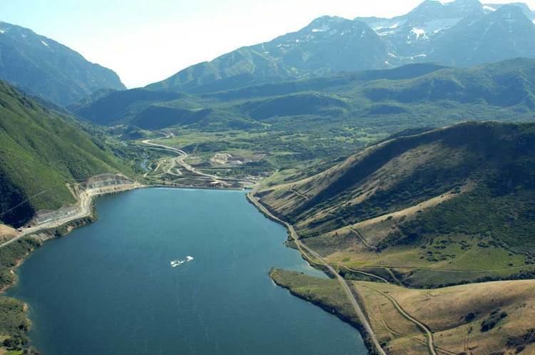
The Deer Creek Dam and Reservoir hydroelectric facilities are located on the Provo River in western Wasatch County, about 16 miles (26 km) northeast of Provo, Utah. The dam is a zoned earthfill structure 235 feet (72 m) high with a crest length of 1,304 ft (397 m). The dam contains 2,810,000 cubic yards (2,150,000 m³) of material and forms a reservoir of 152,570 acre foot (188,190,000 m3) capacity. Construction of the project began in May 1938 and was completed in 1941. The reservoir supplies water for agricultural, municipal and industrial use. Recreational activities on and around the reservoir include boating, fishing, camping, swimming and water skiing.
Map of Deer Creek Reservoir, Utah 84032, USA
The Deer Creek Dam is the key structure of the Provo River Project managed by the U.S. Department of the Interior Bureau of Reclamation.
Deer Creek Reservoir is the main feature of Deer Creek State Park.
Deer Creek is home to several fish species, including Largemouth and Smallmouth Bass, Rainbow Trout, Brown Trout, Yellow Perch, Walleye and Common Carp.