Girish Mahajan (Editor)

Dawn Wright

Updated on
Edit
Like
Comment
Share on FacebookTweet on TwitterShare on LinkedInShare on Reddit
Nationality
  
American

Fields
  
Geography, Oceanography

Doctoral advisor
  
Raymond C. Smith

Dawn Wright Esri Appoints Dawn J Wright as Chief Scientist

Born
  
April 15, 1961 (age 55) (
1961-04-15
)

Other academic advisors
  
Michael Frank Goodchild, Ken C. Macdonald, Rachel Haymon

Known for
  
Ocean GIS, data modeling

Notable awards
  
American Association for the Advancement of Science Fellow Leopold Leadership Fellow Oregon Professor of the Year

Books
  
Arc Marine: GIS for a Blue Planet, Marine Geographical Information Systems: Theory and Applications

Alma maters
  
University of California, Santa Barbara, Texas A&M University, Wheaton College

People also search for
  
Ned Dwyer, Darius J. Barlett

Institutions
  
Esri, Oregon State University

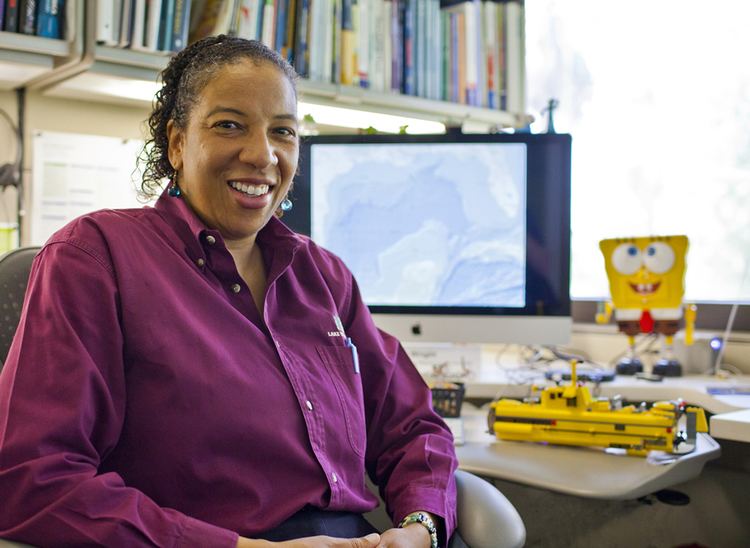
Dawn Jeannine Wright (born April 15, 1961) is an American geographer and oceanographer. She is a leading authority in the application of geographic information system (GIS) technology to the field of ocean and coastal science, and played a key role in creating the first GIS data model for the oceans. Wright is Chief Scientist of the Environmental Systems Research Institute (aka Esri). She has also been a professor of geography and oceanography at Oregon State University since 1995 and is a former Oregon Professor of the Year as named by the Council for the Advancement and Support of Education and the Carnegie Foundation for the Advancement of Teaching. Wright was the first African-American female to dive to the ocean floor in the deep submersible ALVIN.

Contents

Dawn Wright Diving into Esri39s Ocean and Natural Science Initiatives ArcWatch

Education

Dawn Wright Geological Society of America Honors Esri Chief Scientist Dawn J

Wright earned a Bachelor of Science cum laude in geology from Wheaton College (Illinois) in 1983, a Master of Science in oceanography from Texas A&M University in 1986, and an Individual Interdisciplinary Ph.D. in Physical Geography and Marine Geology from UCSB. In 2007 she received a Distinguished Alumna Award from UCSB and was also a UCSB College of Letters and Science commencement speaker.

Career

Dawn Wright duskgeoorsteduimagesbiophoto2jpg

Wright's research interests are mapping of seafloor spreading zones and coral reefs, spatial analysis and geographic information systems as applied to the marine environment. She co-edited one of the first books on marine GIS and is widely known as one of the most influential researchers in this area. Another influential work was a 1997 article widely cited for its analysis of the perception of GIS among geographers in the early 1990s.

Dawn Wright Ocean Exploration 2020 National Forum Keynote Speakers Dr Dawn Wright

Wright began her career as a seagoing marine technician for the Ocean Drilling Program, sailing on ten 2-month expeditions from 1986 to 1989 aboard the JOIDES Resolution, mostly throughout the Indian and Pacific Oceans. Her most prominent service has included the National Academy of Sciences Ocean Studies Board, the Science Advisory Board of NOAA, the Science Advisory Board of the EPA, the National Council of the American Association of Geographers, and Research Chair and Board Member of the University Consortium for Geographic Information Science. A strong advocate of STEM as well as science communication, she has been profiled by outlets such as Women Oceanographers.org, The Oceanography Society, The Atlantic, NOAA's Sea Grant Program, NOAA's National Marine Sanctuaries Program, Science magazine, Harvard Design magazine, Environment, Coastal & Offshore (ECO) magazine, The HistoryMakers, Moment for Action, COMPASS Blogs, Ensia, "Nature" News, "BBC" radio and a host of student projects (e.g.,).

Awards and Honors

Wright is an elected fellow of the American Association for the Advancement of Science and of the Aldo Leopold Leadership Program. Other honors include:

  • Fellow of the Geological Society of America, 2016
  • Randolph W. “Bill” and Cecile T. Bromery Award for Minorities, Geological Society of America, 2015
  • Leptoukh Lecture Award, Earth and Space Science Informatics Focus Group, American Geophysical Union (AGU), 2015
  • Distinguished Teaching Honors, Association of American Geographers (now the American Association of Geographers), 2013
  • Presidential Achievement Award, Association of American Geographers (now the American Association of Geographers), 2012
  • Milton Harris Award for Excellence in Basic Research, OSU College of Science, 2005
  • NSF CAREER Award, 1995
  • Selected Publications

    Wright has authored nearly 70 peer-reviewed journal articles and 7 books. A selection is listed here.

  • Wright, Dawn (2016). Ocean Solutions, Earth Solutions (2nd ed.). Redlands, CA: Esri Press. p. 500. ISBN 9781589484603. Retrieved 15 January 2017. 
  • Wright, Dawn (2016). "Toward a digital resilience". Elementa: Science of the Anthropocene. 4: 000082. doi:10.12952/journal.elementa.000082. 
  • Wright, Dawn (2015). Ocean Solutions, Earth Solutions (1st ed.). Redlands, CA: Esri Press. p. 366. ISBN 9781589483637. Retrieved 15 January 2017. 
  • Wright, Dawn (2012). "Theory and application in a post-GISystems world". International Journal of Geographical Information Science. 26 (12): 2197–2209. doi:10.1080/13658816.2012.713957. 
  • Wright, Dawn; Wang, Shaowen (2011). "The emergence of spatial cyberinfrastructure". Proceedings of the National Academy of Sciences. 108 (14): 5488–5491. doi:10.1073/pnas.1103051108. PMC 3078415. PMID 21467227. 
  • Wright, Dawn; Duncan, Sally; Lach, Denise (2009). "Social power and GIS technology: A review and assessment of approaches for natural resource management". Annals of the Association of American Geographers. 99 (2): 254–272. doi:10.1080/00045600802686299. 
  • Wright, Dawn; Heyman, William (2008). "Marine and coastal GIS for geomorphology, habitat mapping, and marine reserves". Marine Geodesy. 31 (4): 299–317. 
  • Wright, Dawn J.; Blongewicz, Michael; Halpin, Patrick N; Breman, Joe (2007). Arc Marine: GIS for a Blue Planet. Redlands, CA: Esri Press. p. 202. ISBN 978-1-58948-017-9. Retrieved 31 May 2016. 
  • Wright, Dawn; Bartlett, Darius (2000). Marine and Coastal Geographical Information Systems (1st ed.). London: Taylor & Francis. p. 320. ISBN 0-7484-0862-2. Retrieved 31 May 2016. 
  • Wright, Dawn J.; Bloomer, Sherman H.; MacLeod, Christopher J.; Taylor, Brian; Goodliffe, Andrew, M. (2000). "Bathymetry of the Tonga Trench and forearc: A map series". Marine Geophysical Researches. 21 (5): 489–512. Retrieved 23 March 2016. 
  • Wright, Dawn; et al. (2002). "Crustal fissuring on the crest of the southern East Pacific Rise, 17° 15'-40'S". Journal of Geophysical Research. 107. doi:10.1029/2001JB000544. 
  • Wright, Dawn (2012). Undersea with GIS. Redlands, CA: Esri Press. p. 253. ISBN 1-58948-016-3. 
  • Wright, Dawn (1999). "Getting to the bottom of it: Tools, techniques, and discoveries of deep ocean geography". The Professional Geographer. 51 (3): 426–439. doi:10.1111/0033-0124.00177. 
  • Wright, Dawn J.; et al. (1997). "Demystifying the persistent ambiguity of GIS as "tool" versus "science,"". Annals of the Association of American Geographers. 87 (2): 346–362. doi:10.1111/0004-5608.872057. Retrieved 31 May 2016. 
  • Wright, Dawn; Goodchild, Michael F. (1997). "Data from the deep: Implications for the GIS community". International Journal of Geographical Information Science. 11 (6): 523–528. doi:10.1080/136588197242176. 
  • Wright, Dawn; et al. (1995). "Breaking new ground: Estimates of crack depth along the axial zone of the East Pacific Rise (9° 12'-54'N)". Earth and Planetary Science Letters. 134: 441–457. Bibcode:1995E&PSL.134..441W. doi:10.1016/0012-821x(95)00081-m. 
  • Wright, Dawn; et al. (1995). "Crustal fissuring and its relationship to magmatic and hydrothermal processes on the East Pacific Rise crest (9° 12' - 54'N)". Journal of Geophysical Research. 100 (B4): 6097–6210. Bibcode:1995JGR...100.6097W. doi:10.1029/94jb02876. 
  • References

    Dawn Wright Wikipedia


    Similar Topics