
Sovereign state United Kingdom Region East Midlands Admin. HQ Daventry Area 662.5 km² | Constituent country England Administrative county Northamptonshire Area rank 58th University Moulton College | |
 | ||
Points of interest Daventry Country Park, Northampton and Lamport, Cottesbrooke Hall, Kelmarsh Hall, Brixworth Country Park Destinations Northampton, Market Harborough, Daventry, Brixworth, Canons Ashby | ||
Daventry district council planning committee meeting january 28 2015
Daventry is a local government district in Northamptonshire, England. Its council is based in the town of Daventry.
Contents
- Daventry district council planning committee meeting january 28 2015
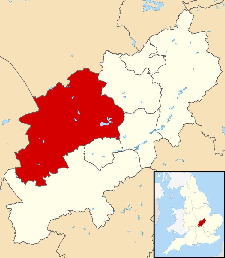
- Map of Daventry District UK
- Settlements
- Historical settlements
- Energy policy
- References
Map of Daventry District, UK
The district was created on 1 April 1974, under the Local Government Act 1972, by a merger of the historic municipal borough of Daventry with the Daventry Rural District and most of the Brixworth Rural District. The town of Daventry became an unparished area with Charter Trustees and remained so until 2003 when a civil parish was created, roughly corresponding with the boundaries of the former borough, so allowing Daventry to have its own town council.
At the 2011 Census, the district had a population of 77,843, a little under a third of whom (25,026) lived in the town of Daventry. Other significant settlements include Brixworth, Long Buckby and Weedon Bec. The rest of the district is predominantly rural.
Settlements
Historical settlements
Energy policy
In May 2006, a report commissioned by British Gas showed that housing in the district of Daventry produced the 7th highest average carbon emissions in the country at 7,276 kg of carbon dioxide per dwelling.