
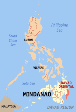
Country Philippines Area 5,679.64 km2 Capital Mati Governor Lakas-CMD | Region Davao Region Founded May 8, 1967 | |
 | ||
Languages spoken Cebuano, Davawenyo, Mandaya, Kamayo, Chavacano de Davao | ||
Map of Davao Oriental
Davao Oriental (Cebuano: Sidlakang Dabaw) is a province in the Philippines located in the Davao Region in Mindanao. Its capital is Mati and borders Compostela Valley to the west, and Agusan del Sur and Surigao del Sur to the north.
Contents
- Map of Davao Oriental
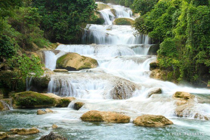
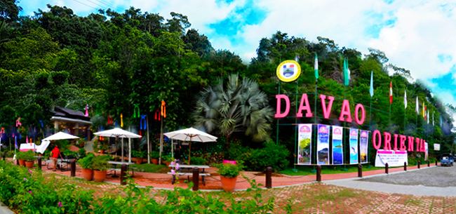
- News1 davao oriental ipinagmalaki ang best diving site at tourists destinations nito
- Its more fun in davao oriental philippines
- Precolonial and Spanish periods
- American period
- World War II
- Independence
- Geography
- Climate
- Administrative divisions
- Demographics
- Economy
- References
Davao Oriental is the easternmost province of the country with Pusan Point as the easternmost location. The Philippine Sea, part of the Pacific Ocean, faces Davao Oriental to the east. Part of the province lies on an unnamed peninsula that encloses the Davao Gulf to the west.
The province is the top producer of coconut and copra in the country, earning the province the title Coconut capital of the Philippines.
News1 davao oriental ipinagmalaki ang best diving site at tourists destinations nito
Its more fun in davao oriental philippines
Precolonial and Spanish periods
The present territory of Davao Oriental was covered by the historical region of Caraga, which was under the Sultanate of Maguindanao. The Spaniards established a permanent settlement in the region in 1591, and in 1844, the area was ceded by the Sultanate to Spain. An expedition was sent by the colonial government in Manila in 1847 to control the region, led by the Spaniard Jose Oyanguren, who settled in the town of Davao and organized the surrounding areas into the province of Nueva Guipozcoa in 1849. The province existed until 1858, when the politico-military commandancias of Davao and Bislig were created in its place. Bislig was incorporated into the District of Davao two years later.
American period
In 1903, the colonial American government created the Moro Province comprising several districts, one of which was Davao. The Moro province was converted in 1914 into the Department of Mindanao and Sulu, and its component districts were made into independent provinces.
World War II
In 1942, the territory of what is now Davao Oriental was occupied by the Japanese Imperial forces.
In 1945, beginning the Battle of Davao from the combined forces of the British, Australian, Dutch and the Filipino troops of the 6th, 101st, 102nd, 103rd, 104th, 106th, 107th and 110th Infantry Division of the Philippine Commonwealth Army and 10th Infantry Regiment of the Philippine Constabulary was supported by the recognized Davaoeño guerrilla fighter units by the attack to the Japanese Imperial forces during the liberation in Eastern Davao or Eastern Davao Campaign until the end of the Second World War.
Independence
On May 8, 1967, through Republic Act No. 4867, the province of Davao was divided into three independent provinces, one of which was Davao Oriental.
Geography
Davao Oriental covers a total area of 5,679.64 square kilometres (2,192.92 sq mi) occupying the eastern tip of the Davao Region in Mindanao. The province is bordered by Compostela Valley to the west, Agusan del Sur and Surigao del Sur to the north, the Davao Gulf to the southwest, and the Philippine Sea to the east and southeast.
The Eastern Pacific Cordillera mountain range encompasses the province. To the east of the range lie narrow strips of coastal areas, which feature several inlets and bays. The province encloses the Davao Gulf to the southwest.
Climate
Davao Oriental has a pronounced rainy season and a short dry season, with maximum rainfall occurring from November to January especially at coastal areas.
Administrative divisions
Davao Oriental comprises 10 municipalities and 1 city, all organized into 2 legislative districts. There are 183 barangays in the province.
Demographics
The population of Davao Oriental in the 2015 census was 558,958 people, with a density of 98 inhabitants per square kilometre or 250 inhabitants per square mile.
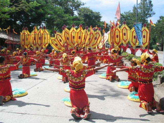
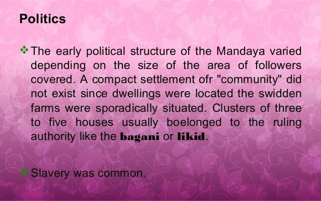
The province is mostly inhabited by Visayan migrants. Ethnic groups include the Mandayas, Mansakas, Manobos and the Kalagans.
The native (and official) language spoken in the province are Kamayo and Mandaya. Cebuano is also spoken, and Chavacano de Davao being spoken by the people from Compostela Valley and Davao City.
Even some of the natives adhere to Christian faith (mostly Catholics), they are syncretic in some of their beliefs. Folklore beliefs include fairies (diwatas).
Economy
Davao Oriental is the top coconut and copra (dried coconut meat) producer in the Philippines. It also is a major producer of abacá, and exports crude oil and copra pellets.