Country Philippines Languages spoken Filipino, English Area 90.13 km2 | Region CALABARZON Mayor Jennifer A. Barzaga (NUP/LP) | |
Colleges and Universities De La Salle University – Dasmarinas, National College of Science and Technology, STI College - Dasmarinas, Technological University of the Philippines-Cavite Campus, Union Theological Seminary | ||
Dasmarinas, officially the City of Dasmarinas (often shortened to Dasma; Filipino: Lungsod ng Dasmarinas), is the largest city, both in terms of area and population in the province of Cavite, Philippines. It is located approximately 27 kilometres (17 mi) south of Manila. As of 2010, Dasmarinas is now the largest component city and the 12th largest city in the country in terms of population with 575,817 people. It is classified as "first-class" city in terms of income classification and has a land area of 90.1 square kilometers (34.8 sq mi).
Contents
- Map of Dasmarinas
- 19 kahaya place and the villas at dasmarinas highlands nikka campo
- History
- Geography
- Economy
- Culture
- The Tanim Lusog Program is a backyard gardening contest for the nutritionally depressed barangays with highest number of underweight children This program spearheaded by the City Nutrition Council aims to teach families and communities the food production technology suited to their environment Lectures on meal management health care practices and related activities are also given to address the incidence of hunger and malnutrition The contest has two categories the home garden and community garden
- References
Map of Dasmarinas
The growing congestion and outward urban expansion of the Metropolitan Manila Area has set up a favorable atmosphere for the development of the city. This inevitable growth is manifested by the influx of industries, presence of large educational and health institutions, and the growing number of subdivisions elevating its economy.
19 kahaya place and the villas at dasmarinas highlands nikka campo
History

In the 19th century during the Spanish Colonial Period, Dasmarinas was originally called Tampus meaning "end of the forest" at the time the place was just a part of its mother town of Imus. It was once a part of a vast Recollect Hacienda that supported all the various missionary activities of the Recollects in the Philippines and in Spain.

On April 9, 1864, a council composed of the Archbishop of Manila, the politico military governor of Cavite, the Prior Provincial of the Augustinian Recollect Order and the parish priest of Imus met to discuss the creation of the new town and parish separated from Imus. At that time, there were only 643 inhabitants that lived in Tampus, the heart of the community. After thorough discussions, the Gobierno Civil Superior of the Islands approved the creation of the new town on May 12, 1864 with Don Juan Ramirez elected as gobernadorcillo (town head).
An ensemble of nipa houses in the other barrios of the hacienda like Malinta, Nancaan, Salacay, Paliparan, Malagasang and Salitran were grouped and migrated into a reduccion (reduction) in Tampus in 1866. Reduccion which originally meant the religious and civic aspect of friar missionary activities, later, came to mean the process of resettling and unifying a community, thereby creating a newly organized town. For the Spanish missionaries and friars, this process was very advantageous not only for evangelization but also for bringing people under the Spanish rule. Thus a new town called with its native name Tampus was formed. From that time on, the people of Tampus built their house within the hearing distance of the church bells – "bajo las toques de campana". The new town could be reached through a good network of roads and bridges built by the best architects and engineers of the Recollect Order.
At the same year, the new town was rechristened Perez-Dasmarinas to honor the 7th Governor General of the Philippines, Don Gomez Perez Dasmarinas (1590-1593). Governor Dasmarinas, a Knight of Santiago, was a native of Galicia, Spain and a former magistrate of Murcia and Cartagena, Spain who brought a lot of economic improvements during the early days of colonization.
Toward the end of 1866, the new town Perez-Dasmarinas has complied with the requirements of a typical Philippine town: a spacious town plaza at the center of the town with the church and the convent made of stone and bricks; a casa tribunal (courthouse) made of wood and nipa; a primary school for children and various houses made of nipa were built on their designated places; and a cemetery located around 200 yards away from the church and surrounded with wooden fence.
The foundation of the town Perez-Dasmarinas was quite unique from all other towns of Cavite. For the first time, a town was created not by a preceding petition of the barrio people and its local officials as required by legal procedures and custom at that time. Instead, high ranking church officials and the Cavite politico military governor were the prime initiators of its foundation.
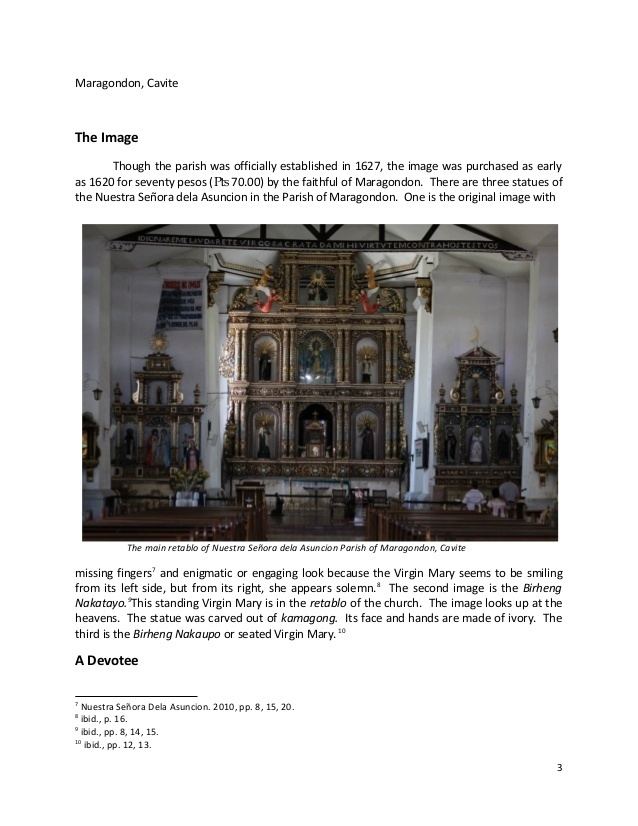
For the sake of the people of a growing town and for their own interest, the Recollects sent a petition to Madrid for the creation of a new parish of Dasmarinas, independent from Imus. Queen Isabella II signed the Royal Order creating the new parish of Perez-Dasmarinas on October 21, 1866. The following year, the construction of the stone parish church of Dasmarinas dedicated to the Virgin Mary as Our Lady of Immaculate Conception was started.
Geography

Dasmarinas City is about 8,234 hectares, 12 kilometers from Metro Manila or the National Capital Region and 27 kilometers south of the center of the City of Manila. It is bounded by the city of Imus and the municipality of Silang, both in Cavite at the north and south respectively, at the east by the towns of San Pedro and Binan by the side of Laguna and Carmona and at the west, it is bounded by General Trias, also in Cavite and a little further from this boundary is Trece Martires City.

It is strategically located at the intermediate zone of the Metropolitan Manila area. With adequate accessibility, Dasmarinas is within the urbanizing development influence of Metro Manila area.
It is composed of the Poblacion and the barangays. The Poblacion which is now divided into four zones is on the westernmost section of the city, Sabang, Salawag and Salitran are to the north and to the south are San Agustin, Langkaan and Sampaloc. Burol, Paliparan, and the Resettlement Area are on the eastern side of the city.
The city of Dasmarinas is landlocked. However, it is not too far from the coastal towns of Rosario, Kawit, Bacoor, Noveleta and Cavite City whose average distance from Poblacion is less than 30 kilometers. It is about the same distance from Laguna de Bay and about 27 kilometers from the resort city of Tagaytay and the famous Taal Lake.
At present, Dasmarinas is served by corridors traversing the central areas which provide linkages to the Metropolitan Manila area core in the north and the developing nodes of Laguna and Batangas.
Economy
The city of Dasmarinas is one of the fastest growing local government units in the province of Cavite. Numerous commercial establishments, which include major shopping malls, fast foods, groceries, convenient stores, restaurants and other service-oriented businesses, are mostly concentrated in the City Centre and the Central Business District. Industrial establishments are located in the outskirts of the city. It has the greatest number of universities in the province.
Culture

Tourism plays a large part in the citys economy. The presence of Aguinaldo Highway and Governors Drive makes the city a stop over for those who are travelling to Tagaytay and Batangas from Metro Manila and to Laguna from the towns on the western part of Cavite. The city has a large selection of hotels and resorts catering to tourists.

The Kadiwa Park located on Congressional Road is a large park featuring sculptures and animatronics of animals and dinosaurs attracts tourists from nearby towns and provinces.
The Museo De La Salle, located within the campus of the De La Salle University-Dasmarinas, is a unique, cultural, cross-disciplinary institution serving as a permanent museum of the De La Salle University System. As a resource center for both indoor and outdoor collections, it dedicates itself to the gathering of collectible objects of intrinsic value significant to the preservation of certain aspects of the Philippine ilustrado lifestyle. It envisions itself to be a leading contributor to the Philippine University museums movement. It seeks to form productive partnerships that serve communities in creative ways. It vows to assist the member schools of the System in the core areas of teaching, research, community outreach, and administration. Through active collaboration with other museums in the nation, it promotes the interests of museology and upholds appreciation of the arts and culture.
The scenic zigzag Dano Street offers a great view of the citys fields and becomes a tiangge or a bazaar during the holiday season.
The Tanim Lusog Program is a backyard gardening contest for the nutritionally depressed barangays with highest number of underweight children. This program spearheaded by the City Nutrition Council aims to teach families and communities the food production technology suited to their environment. Lectures on meal management, health care practices and related activities are also given to address the incidence of hunger and malnutrition. The contest has two categories: the home garden and community garden.

