
Length 801 km | River mouth São Francisco River | |
 | ||
The das Velhas River, of which the source was found to be the waterfall Andorinhas located in the municipality of Ouro Preto, is by length the major tributary of the basin of the São Francisco river. Its water flows into that river at a place called Barra do (Dam of) Guaicuí, municipality of da Palma (MG).
Contents
- Map of Rio das Velhas JequitibC3A1 State of Minas Gerais Brazil
- Historic importance
- Present situation
- Origin of the name
- References
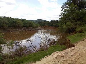
Map of Rio das Velhas, Jequitib%C3%A1 - State of Minas Gerais, Brazil
Historic importance
The das Velhas river has been of great importance in the development of the central region of Minas Gerais, because it is one of the principal roads by which the Golden Century evolved. From its source, the das Velhas River passes through other historical cities in the region, among others Sabará, Santa Luzi, Belo Horizonte and so on.
Recent academic research indicates that the das Velhas river could have been the original path to the discovery of gold in Minas Gerais. By this theory,the explorers from the Northeast walked along the banks of the São Francisco river and went on along the Das Velhas River. It is a more natural passage but much longer than the road from Rio de Janeiro or São Paulo. Passing through the central region of Minas Gerais, the explorers discovered gold and precious stones. Once found, knowing the approximate places, the Paulistas (as people from São Paulo are called) swiftly went through the rough terrain of the mountains by a much shorter but much more difficult and dangerous route. The dispute over the existing mines led to the War of the Emboabas, at the end of which the region, before becoming part of the final São Vicente, (actually region of São Paulo), became a Capitania administered directly by the Portuguese Crown.
Present situation
In the metropolitan region of Belo Horizonte, the Das Velhas river suffered a series of setbacks. A sizable part of the water volume is captured by the Water Treatment Station Agua de Bela Fama. Behind the Station the river receives a great quantity of sewage from the Ribeirão Arrudas and the Ribeirão do Onça, both crossing the City of Belo Horizonte. The result is that the das Velhas River in its best known stretch is a river with yellow water(mostly caused by the iron present in the region's soil), extremely polluted and acid. There is practically no life in the water of the river along that stretch. Because of the historic and environmental importance the Manuelzão project was initiated in 1997 by the Medical Faculty of the University of Minas Gerais, with the goal of finding a way to bring back life in the basin of the Das Velhas. The project initialised a series of goals to sensibilise the public opinion, which will result through the embellishment of public, municipal and state policies. In particular rigorous controls of pollution emitters are important. The project has the ambitious goal of having the Das Velhas river revitalised by the year 2010.
The 31,270 hectares (77,300 acres) Serra do Gandarela National Park was created in 2014 in an effort to protect the water supplying the river, and thus the Belo Horizonte waer supply.
Origin of the name
According to the writer Aníbal Machado, born in Sabará, this river is known to the Indians as Uaimií and by the bandeirantes as Guaicuí, from which the name Dam (Barra) of Guaicuí for the place where the Das Velhas empties into the São Francisco River. In Tupi "gwaimi" means "old" whereas in Uaimii the final "i" means "river". "Rio Das Velhas means "River of the old women".