
Local time Saturday 9:34 AM | Postcode(s) 3304 Postal code 3304 | |
 | ||
Location 400 km (249 mi) W of Melbourne71 km (44 mi) NW of Portland50 km (31 mi) E of Mount Gambier Weather 19°C, Wind E at 13 km/h, 84% Humidity | ||
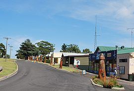
Dartmoor /ˈdɑːtmɔː/ is a rural township on the Princes Highway and the Glenelg River between Heywood and the South Australian border, in southwestern Victoria. At the 2011 census, Dartmoor had a population of 263.
Contents
Map of Dartmoor VIC 3304, Australia
History
Before the township was established the location was known as Woodford Inn. The township was settled in the late 1850s, a Post Office opening on 1 April 1860.
Today
The main industry in the area is the processing of timber from the extensive pine plantations.
Dartmoor has a football team playing in the South West District Football League.
Golfers play at the Dartmoor Golf Club on Wapling Avenue.
Notable residents
References
Dartmoor, Victoria Wikipedia(Text) CC BY-SA