
 | ||
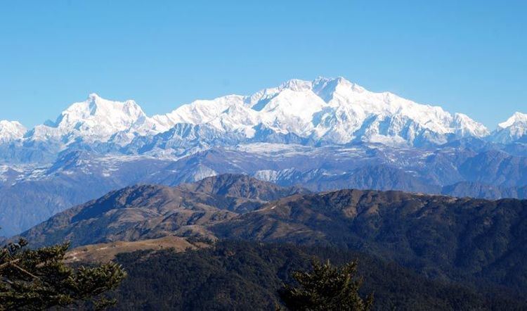
Darjeeling Himalayan hill region or Darjeeling Himalaya is the mountainous area on the North-Western side of the state of West Bengal in India. This region belongs to the Eastern Himalaya range. The Darjeeling district except the Siliguri subdivision constitutes the region. It arises abruptly from the Terai region.
Contents
- Hills to the west of Teesta
- Singalila range
- Darjeeling Karsiang range
- Hills to the east of Teesta
- Rivers
- References
The region slopes from a south to north direction. The river Teesta divides the region in two parts — the region to the east of Teesta and the region to the west of Teesta.
Hills to the west of Teesta
This is the highest region of the Darjeeling Himalaya. Two distinct ranges are visible here — the Singalila range and the Darjeeling-Karsiang range.
Singalila range
The Singalila range is on the western limit of the region and separates Nepal from West Bengal. Singalila National Park is situated here. The four highest peaks of this range are:
- Falut (3,595 m)
- Sandakfu (3,630 m) — the highest point of West Bengal
- Tonglu (3,036 m)
- Sabargram (3,543 m)
See: Singalila Ridge
Darjeeling-Karsiang range
Two notable peaks of this range are Tiger Hill and Senchal.
Hills to the east of Teesta
The Chola range is situated on the Sikkim and Bhutan border. The highest peak is Rishila. The town of Kalimpong is situated in this region. Neora Valley National Park is located here. The relatively low-height Buxa-Jayanti range, a part of the Sivalik, is also located here.
Rivers
Some notable rivers of this region are Mechi, Balason, Rammam, Rangeet, Teesta, and Jaldhaka.