
Vehicle registration RJ Population 2,832 (2001) ISO 3166 code ISO 3166-2:IN | Time zone IST (UTC+5:30) Elevation 479 m Local time Friday 10:02 PM | |
 | ||
Weather 22°C, Wind NE at 3 km/h, 41% Humidity | ||
Dariba is a census town in Rajsamand district in the state of Rajasthan, India.
Contents
Map of Dariba, Rajasthan 313211
Geography
Dariba is located at 24.95°N 74.13°E / 24.95; 74.13. It has an average elevation of 479 metres (1571 feet).
Demographics
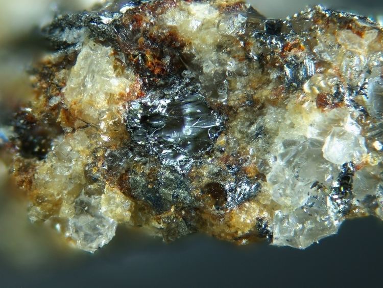
As of 2001 India census, Dariba had a population of 2832. Males constitute 53% of the population and females 47%. Dariba has an average literacy rate of 84%, higher than the national average of 59.5%: male literacy is 89% and, female literacy is 79%. In Dariba, 8% of the population is under 6 years of age.Dariba is an important zinc and lead mining and smelting region of Rajasthan.
References
Dariba, Rajasthan Wikipedia(Text) CC BY-SA