
Country Language spoken Marathi | State | |
Colleges and Universities Dr. Balasaheb Sawant Konkan Krishi Vidyapeeth, College of Forestry, Dapoli | ||
Dapoli is a town in Ratnagiri district, Maharashtra. It is 215 km (134 mi) from the state capital of Mumbai.
Contents
- Map of Dapoli
- Seagull birds in anjarle beach dapoli ratnagiri mov
- Outside view of suvarnadurg fort at harne bandar dapoli ratnagiri
- Geography
- Places of interest
- References
Map of Dapoli
Seagull birds in anjarle beach dapoli ratnagiri mov
Outside view of suvarnadurg fort at harne bandar dapoli ratnagiri
Geography
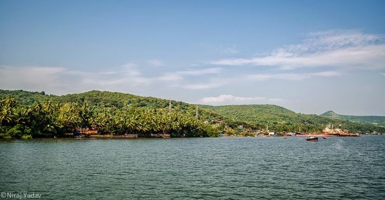
Dapoli is separated from the Sahyadri range by the Khed taluka. Dapoli has a seaboard of 50 km (31 mi) which stretches from Burondi, Kelshi to Dabhol. The coastline differs little in its general characteristics from that of other parts of Konkan. It is densely covered by coconut farms. The principal rivers are Bharja in the north and Vashishthi in the south. A small river called Jog flows through Bandhtivare, Sarang and Tadil into the Arabian sea.
The town is located at an altitude of 800 ft (240 m). Also, called "Mini Mahabaleshwar" because of its cool climate throughout the year. It is 8 km (5.0 mi) from the Arabian Sea and acts as the main town (Taluka headquarters) for several small surrounding villages such as Anjarle, Mandivali, Sarang, Bandhtivare, Bhopan, Harnai, Dabhol, Navse, Unhavare, Jalgaon, Gavhe, Gimhavane, Asud, Vanand, Kherdi, Karde, Visapur, Murud and Umberghar.