
Country United States FIPS code 39-20114 Elevation 303 m Population 1,020 (2013) Area code 740 | Time zone Eastern (EST) (UTC-5) GNIS feature ID 1039574 Zip code 43014 Local time Friday 7:26 AM | |
 | ||
Weather -4°C, Wind W at 13 km/h, 73% Humidity Area 145 ha (142 ha Land / 3 ha Water) | ||
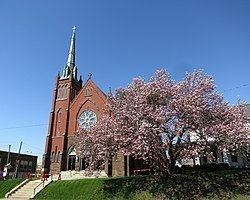
Danville is a village in Knox County, Ohio, United States. The population was 1,044 at the 2010 census.
Contents
- Map of Danville OH 43014 USA
- History
- Geography
- 2010 census
- 2000 census
- Notable people
- Points of interest
- References
Map of Danville, OH 43014, USA
History
Modern Danville had its start in 1923 by the merging of two neighboring rival post offices called Buckeye City and Danville.
Geography
According to the United States Census Bureau, the village has a total area of 0.56 square miles (1.45 km2), of which 0.55 square miles (1.42 km2) is land and 0.01 square miles (0.03 km2) is water.
Buckeye City is a neighborhood of Danville. Buckeye City was laid out in 1880, and was annexed by the village of Danville in 1923.
2010 census
As of the census of 2010, there were 1,044 people, 425 households, and 281 families residing in the village. The population density was 1,898.2 inhabitants per square mile (732.9/km2). There were 474 housing units at an average density of 861.8 per square mile (332.7/km2). The racial makeup of the village was 97.9% White, 0.6% African American, 0.4% Native American, 0.1% Asian, 0.2% from other races, and 0.9% from two or more races. Hispanic or Latino of any race were 1.2% of the population.
There were 425 households of which 36.5% had children under the age of 18 living with them, 43.5% were married couples living together, 16.0% had a female householder with no husband present, 6.6% had a male householder with no wife present, and 33.9% were non-families. 28.2% of all households were made up of individuals and 10.1% had someone living alone who was 65 years of age or older. The average household size was 2.46 and the average family size was 2.98.
The median age in the village was 33.8 years. 28.3% of residents were under the age of 18; 8.4% were between the ages of 18 and 24; 26% were from 25 to 44; 24.4% were from 45 to 64; and 12.8% were 65 years of age or older. The gender makeup of the village was 49.2% male and 50.8% female.
2000 census
As of the census of 2000, there were 1,104 people, 442 households, and 292 families residing in the village. The population density was 2,055.1 people per square mile (789.4/km²). There were 479 housing units at an average density of 891.7 per square mile (342.5/km²). The racial makeup of the village was 98.10% White, 0.09% African American, 0.09% Native American, 0.18% Asian, and 1.54% from two or more races. Hispanic or Latino of any race were 0.36% of the population.
There were 442 households out of which 32.4% had children under the age of 18 living with them, 50.0% were married couples living together, 12.4% had a female householder with no husband present, and 33.9% were non-families. 28.7% of all households were made up of individuals and 13.3% had someone living alone who was 65 years of age or older. The average household size was 2.50 and the average family size was 3.09.
In the village, the population was spread out with 28.1% under the age of 18, 10.6% from 18 to 24, 25.8% from 25 to 44, 19.9% from 45 to 64, and 15.6% who were 65 years of age or older. The median age was 33 years. For every 100 females there were 101.1 males. For every 100 females age 18 and over, there were 90.9 males.
The median income for a household in the village was $28,636, and the median income for a family was $31,375. Males had a median income of $30,208 versus $22,500 for females. The per capita income for the village was $14,595. About 15.0% of families and 15.2% of the population were below the poverty line, including 18.1% of those under age 18 and 13.5% of those age 65 or over.