
Country Thailand Time zone THA (UTC+7) Geocode 7111 Population 32,248 (2005) | Seat Dan Makham Tia Postal code 71260 Area 807.1 km² Province Kanchanaburi Province | |
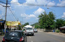 | ||
Dan Makham Tia (Thai: ด่านมะขามเตี้ย) is a district (Amphoe) in the southern part of Kanchanaburi Province, central Thailand.
Contents
Map of Dan Makham Tia District, Kanchanaburi, Thailand
History
The area of Dan Makham Tia was a village more than 200 years. It was a border village of Mueang Kanchanaburi to Burma.
In the area had a short Makham tree (Tamarindus indica), so people called the village Ban Nong Makham Tia. Later was changed to be Dan Makham Tia.
The minor district (King Amphoe) was created on April 1, 1990 by splitting of the three tambon Dan Makham Tia, Klondo and Chorakhe Phueak from Mueang Kanchanaburi district. It was upgraded to a full district on September 8, 1995.
Geography
Neighboring districts are (from the north clockwise) Mueang Kanchanaburi, Tha Muang of Kanchanaburi Province, Chom Bueng and Suan Phueng of Ratchaburi Province.
The most important water resources in the area are the Khwae Noi and Phachi River.
Administration
The district is subdivided into 4 subdistricts (tambon), which are further subdivided into 39 villages (muban'). Dan Makham Tia is a township (thesaban tambon) which covers parts of the tambon Dan Makham Tia. There are further 4 Tambon administrative organizations (TAO).