
Population 292 (Parish-2011) Sovereign state United Kingdom Area 7.9 km² Local time Thursday 4:39 AM Dialling code 01435 | OS grid reference TQ657190 Post town HEATHFIELD District Rother | |
 | ||
Weather 10°C, Wind SW at 13 km/h, 95% Humidity | ||
Dallington is a village and civil parish in the Rother District of East Sussex, England. It is located eight miles (13 km) west of Battle and five miles (8 km) east of Heathfield.
Contents
Map of Dallington, Heathfield, UK
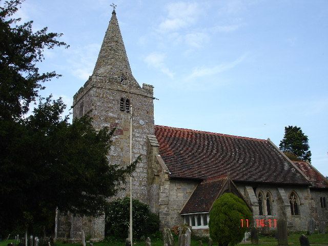
The parish church of St Giles is a Grade II* listed building. The unusual tower and spire date from the early 16th century, but the remainder was rebuilt in 1864 by architects Habershon and Brock
Governance
The lowest level of government is the Dallington parish council. The parish council is responsible for local amenities such as the provision of litter bins, bus shelters and allotments. They also provide a voice into the district council meetings. The parish council comprises five councillors with elections being held every four years.
Rother District council provides the next level of government with services such as refuse collection, planning consent, leisure amenities and council tax collection. Dallington lies within the Darwell ward, which provides two councillors.
East Sussex county council is the third tier of government, providing education, libraries and highway maintenance. Brightling falls within the Rother North West ward.
The UK Parliament constituency for Dallington is Bexhill and Battle.
At European level, Dallington is represented by the South-East region, which holds ten seats in the European Parliament.