
- elevation 374 m (1,227 ft) - elevation 189 m (620 ft) Country Australia | Length 75 km | |
 | ||
- location Boyagarring Conservation Reserve | ||
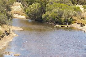
The Dale River is a perennial river located in the Wheatbelt region of Western Australia.
Map of Dale River, Western Australia, Australia
Rising on the eastern slopes of the Darling Scarp, the river flow generally east by north, joined by six major tributaries including the Dale River South, Gibb Gully, Connelly Gully, Sherlock Gully, Flint Gully and Talbot Brook. The river reaches its mouth to join the Avon River approximately 10 kilometres (6.2 mi) west of Beverley near the Avondale Agricultural Research Station. The river descends 185 metres (607 ft) over its 75-kilometre (47 mi) course.
The Dale River was named in honour of Robert Dale, the first European explorer to venture into the Darling Ranges in 1829.
References
Dale River Wikipedia(Text) CC BY-SA