
Time zone MST (UTC+6:30) Area 85.4 km² Local time Thursday 2:58 AM Area code 1 | Township Dagon Seikkan Postal codes 11441 Postal code 11441 Population 93,823 (Dec 2008) | |
 | ||
Weather 25°C, Wind W at 5 km/h, 88% Humidity | ||
Authorities removes slums in dagon seikkan township
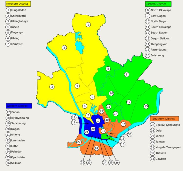
Dagon Seikkan Township (Burmese: ဒဂုံဆိပ်ကမ်း မြို့နယ် [dəɡòʊɴ sʰeɪʔkáɴ mjo̰nɛ̀]) is an urban township of Yangon, Burma (Myanmar). Located in the east-central part of the city of Yangon (Rangoon). Satellite communities and industry moved into the township in the 1990s, growing from a rural population of under 10,000 to almost 100,000 by 2010. As of 2009, Dagon Seikkan consisted of 39 wards and five village tracts. As of 2000, the township had 10 primary schools, two middle schools and a high school. The township is in an industrial area of the city. Nationalities Youth Resource Development Degree College, Yangon is located in the township.
Contents
As of 2007, Dagon Seikkan is linked to Thanlyin Township by the Dagon Bridge, the second bridge to be built across the Bago River at Yangon.
Borders
Dagon Seikkan Township shares borders with Hlegu Township to the north, South Dagon Township to the northwest, Thaketa Township to the southwest, and Thanlyin Township to the east and southeast. It borders on the Bago River to the east and southeast.