
 | ||
Dagali is a small mountain village in Buskerud, Norway.
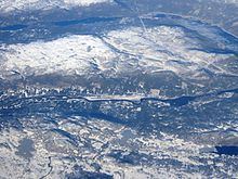
Map of 3588 Dagali, Norway
Dagali is located in Hol municipality. The village stretches from Pålsbufjorden on the east to the border of the Hardangervidda National Park in the west, a distance of approximately 40 km. The river Numedalslågen runs though the village. Dagali had an airport, Geilo Airport, Dagali, that is no longer in use. The site is currently used by DagaliOpplevelser, which offers outdoor recreational activities including water rafting and snowmobiling.
Dagali church (Dagali kirke) dates from 1850. The church was constructed of wood and has the seating capacity of around 200 people. Dagali church was rebuilt and restored during 1972-73. Dagali church is located off Norwegian National Road Rv 40, about 25 kilometres from Geilo.
Climate
Dagali features a subarctic climate (Köppen Dfc) with cold winters and somewhat cool summers, typical of higher altitudes(798m asl). Dagali airport weather station has some of the coldest temperatures in Southern Norway with a mean temperature in the coldest month (January) of -11,2°C for the period 2001 to present. This is especially true considering how much the climate of Norway has warmed only in the last decades. Precipitation remains moderate at 515mm yearly (Fagerlund 871m asl - 1958-88) for one of the two weather stations(the one no longer in usage) there.
Averages from the no longer operational Dagali-Fagerlund and extremes. Back then, January averaged -8.9 and July averaged 10.8 making it stlll a subarctic (Dfc) climate.