
 | ||
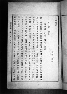
Daehanjiji (Korean: 대한지지; Hanja: 大韓地誌) is a Korean geography book about the Great Korean Empire, written by Hyeun Chae (Korean: 현채; Hanja: 玄采) and published by Gwangmun-sa (Korean: 광문사; Hanja: 廣文社), Seoul. Hyeun Chae wrote Daehanjiji, a two-volume set of Korean elementary school geography books, in 1899 translating and compiling Japanese and Korean sources. The titles, authors, and chronologies of source material for the compilation are not always stated, yet Gomatsu Susumu(小松運)'s Chōsenhachidō-shi(朝鮮八道誌; Joseon Paldo-ji, 1887) and Matsumoto Nikichi(Kendo)(松本仁吉; a.k.a. 謙堂)'s Chōsenchishi Yoryaku (朝鮮地誌要略; Joseon Jiji Yoryak, 1894) and their styles are suspected as primary sources and models of emulation. The author states in the postface that he employed several Japanese geographies on Korea, and that he supplemented these with the historical sections from Shinjeung Dongguk Yeojiseungram. Daehanjiji was published in 1899 and reprinted in 1901. It gave a summary description of late 19th century Korean geography with greater emphasis on physical geography. The written language conformed to the then innovative Gukhanmun Honyongche, one combining han'geul and hanja, and was popular for the relative ease of deciphering. As the first western style geography textbook published in late Joseon dynasty, it contributed to the Gaehwa movement, the opening up to enlightenment for the Korean masses and raising awareness and unity as a nation by inviting commoners to learn everything they could about the Korean Empire and its landscape, namely the Korean Peninsula at late 19th century. It was foreworded by Lee Gyu-hwan (Korean: 이규환; Hanja: 李圭桓), Director of Editorial Office, Ministry of Education. Daehanjiji was employed in the school system, but was banned, confiscated, and burned by Protectorate General by Notice No. 72 of Nov. 19, 1910.
Contents
- One of many geographies published in Gojongs reign
- Daehan Jiji Controversy Japanese MOFAs 1952 memo Were Koreans aware of claimed sovereignty over Dokdo in 1899
- Identifying the actual placenames of Korea lying behind the abstract figures I
- Identifying the actual four corners of Korea lying behind the abstract figures II
- From 1883 Kanei Suiroshi to 1907 Kankoku Shoran Korean territories outside the four coordinates
- The current limits of modern Korea South and North combined
- 1875 1890s Trends in Japanese geographies on Ulleungdo and Dokdo
- 1870s 1880s The Japanese rediscovery of Ulleung Is and the land grab incident
- The aftermath of the land grab
- Why the 1883 1886 Kanei Suiroshi limits excluded Ulleung Is and Dokdo
- Evaluating JMOFAs evidence
- The Japan Sea controversy
- References
One of many geographies published in Gojong's reign
Daehanjiji was the last of the three geographical works of the latter 1900s; the provincial gazetteers that were written from 1871 onward, Joseon Jiji (朝鮮地誌; 1895, 1 vol.), and Dahanjiji itself. Its reprinting in 1901 was followed by other geographical works by authors who were inspired by its novelty, yet who were disappointed for its brevity and obvious omissions. Thus were published Daehan Shinjiji (大韓新地志, Jang Jiyeon, 1907), Chodeung Dahanjiji (初等大韓地誌, An Jonghwa, 1907), and again Chodeung Dahanjiji (初等大韓地誌 An Jonghwa, Ryun Yeon, 1908), which described Usan Island as lying to the Southeast of Ulleung Island. As for institutional innovations in the local administrations since the Seven Year War of 1593 down to 1904, the 1908 Jeungbo Munheon Bigo, The Expanded Encyclopedia of the Eastern Nation, succinctly noted the redevelopment of Ulleung Island of 1883, its promotion to Uldo County of 1900, and the incorporation of Usan Island under Uldo County jurisdiction.
Daehan Jiji Controversy: Japanese MOFA's 1952 memo., "Were Koreans aware of claimed sovereignty over Dokdo in 1899?"
Daehanjiji describes the domain of the Great Korean Empire as stretching from 33°15′N to 42°25′N and from 124°30′E to 130°35′E, which would exclude the Liancourt Rocks (located at 37°14′30″N 131°52′0″E), ownership of which is claimed by both Korea and Japan.
The said four corners of the Korean Peninsula given in the overview, first chapter of Daehanjiji, are as follows, yet it is not clear which locations the figures might represent, obscuring further analysis that might offer a solution either way.
Identifying the actual placenames of Korea lying behind the abstract figures I
Although Daehanjiji garnered praise as a pioneering western-style textbook in late Joseon dynasty, it was criticized for its overt dependence on Japanese geographies. It had borrowed heavily from the Japanese sources in its overview, format, and content material, and its longitude-latitude co-ordinates were literally translated from the Japanese books rather than taking Korean measurements conducted by the Korean government. The so-called four limits of the Korean peninsula, including the eastern limit ~~ that has drawn heavy criticism, have been identified in such prior Japanese geographies as follows.
Identifying the actual four corners of Korea lying behind the abstract figures II
Fortunately, an identical set of longitude-latitude four-corner limits has been identified in the 1907 geography by Tokunaga Isamijo's (德永勲美) Kankoku Shoran (韓國總覽; 한국총람) where the real geographical locations are given beside the abstract so-called four corners figures.
In light of these actual locations, the question raised by the Japanese MOFA becomes more understandable in concrete geographical terms. To reiterate JMOFA's challenge, the fact that Daehanjiji lists these four corner limits to describe Korea indicates Koreans did not regard Dokdo-Takeshima (Liancourt Rocks) as Korean territory. In refutation, it has been noted the fact that Ulleung Island around that time, with a longitude measurement of 130°57′E according to the Japanese Navy and 130°58′E according to the British Navy, also lies outside the so-called four corners but has always been considered Korean territory indicates the so-called four-corner limits should not be taken literally, as they might have meant something quite different in the minds of those who first coined them. In addition, it has further been brought to attention that the following locations also lie outside the so-called four-corner coordinates yet they are sovereign territories at least since Gojong's reign.
From 1883 Kan’ei Suiroshi to 1907 Kankoku Shoran: Korean territories outside the four coordinates
The current limits of modern Korea, South and North combined
1875-1890s: Trends in Japanese geographies on Ulleungdo and Dokdo
(to be fleshed out shortly)
1870s-1880s: The Japanese rediscovery of Ulleung Is. and the land grab incident
(to be fleshed out shortly)
The aftermath of the land grab
(to be fleshed out shortly)
Why the 1883-1886 Kan’ei Suiroshi limits excluded Ulleung Is. and Dokdo
(to be fleshed out shortly)
Evaluating JMOFA's evidence
(to be fleshed out shortly)
The 'Japan Sea' controversy
(to be fleshed out shortly)