
Established 2002 Time zone ACST (UTC+9:30) Founded 2002 | Postcode(s) 5223 Elevation 6 m Postal code 5223 | |
 | ||
Population 257 (shared with other localities within the “State Suburb of Menzies”) (2011 census) Region Fleurieu and Kangaroo Island | ||
Cygnet River is a locality in the Australian state of South Australia located on Kangaroo Island about 192 kilometres (119 mi) south-west of the state capital of Adelaide and about 12 kilometres (7.5 mi) from the municipal seat of Kingscote.
Map of Cygnet River SA 5223, Australia
Its boundaries were created in 2002 in respect to “the long established name” which is reported to be derived from the stream located within its boundaries.
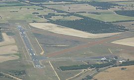
The major land use within the locality is primary production. The locality also includes the Kingscote Airport and the Cygnet Estuary Conservation Park.
Cygnet River contains the following places listed on the South Australian Heritage Register - the Farm and Eucalyptus Oil Distillery Ruins, Duck Lagoon and the Dwelling & Eucalyptus Oil Distillery Ruins (Cygnet River).
Cygnet River is located within the federal division of Mayo, the state electoral district of Finniss and the local government area of the Kangaroo Island Council.