
Country United States Time zone Eastern (EST) (UTC-5) Area 85 ha Zip code 43413 Local time Tuesday 5:41 AM | FIPS code 39-19820 Elevation 215 m Population 608 (2013) Area code 419 | |
 | ||
Weather 14°C, Wind S at 34 km/h, 71% Humidity | ||
Dr temple grandin visits cygnet ohio
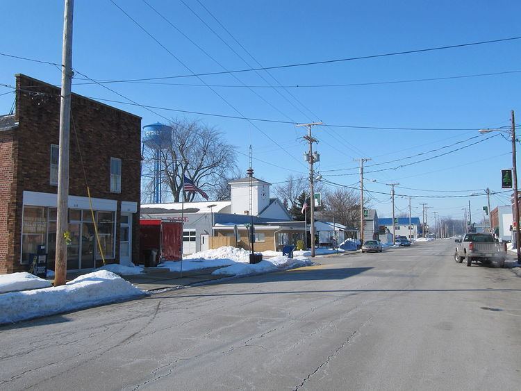
Cygnet is a village in Wood County, Ohio, United States. The population was 597 at the 2010 census.
Contents
- Dr temple grandin visits cygnet ohio
- Map of Cygnet OH 43413 USA
- Hd up at cygnet ohio
- History
- Geography
- 2010 census
- 2000 census
- References
Map of Cygnet, OH 43413, USA
Hd up at cygnet ohio
History
Cygnet was originally called Pleasant View, and under the latter name was platted in 1883. A post office called Cygnet has been in operation since 1883. The village was incorporated in 1889.
Geography
Cygnet is located at 41°14′28″N 83°38′37″W (41.241093, -83.643500).
According to the United States Census Bureau, the village has a total area of 0.33 square miles (0.85 km2), all land.
2010 census
As of the census of 2010, there were 597 people, 208 households, and 161 families residing in the village. The population density was 1,809.1 inhabitants per square mile (698.5/km2). There were 228 housing units at an average density of 690.9 per square mile (266.8/km2). The racial makeup of the village was 93.6% White, 1.2% African American, 0.7% Native American, 0.7% Asian, 1.3% from other races, and 2.5% from two or more races. Hispanic or Latino of any race were 5.7% of the population.
There were 208 households of which 43.8% had children under the age of 18 living with them, 55.3% were married couples living together, 13.5% had a female householder with no husband present, 8.7% had a male householder with no wife present, and 22.6% were non-families. 18.3% of all households were made up of individuals and 8.2% had someone living alone who was 65 years of age or older. The average household size was 2.87 and the average family size was 3.22.
The median age in the village was 33.4 years. 30.3% of residents were under the age of 18; 8.4% were between the ages of 18 and 24; 24.4% were from 25 to 44; 27.8% were from 45 to 64; and 9% were 65 years of age or older. The gender makeup of the village was 47.9% male and 52.1% female.
2000 census
As of the census of 2000, there were 564 people, 211 households, and 158 families residing in the village. The population density was 1,672.1 people per square mile (640.5/km²). There were 222 housing units at an average density of 658.1 per square mile (252.1/km²). The racial makeup of the village was 97.16% White, 0.35% African American, 0.35% Native American, 0.71% from other races, and 1.42% from two or more races. Hispanic or Latino of any race were 2.66% of the population.
There were 211 households out of which 34.6% had children under the age of 18 living with them, 61.6% were married couples living together, 8.1% had a female householder with no husband present, and 25.1% were non-families. 21.8% of all households were made up of individuals and 9.5% had someone living alone who was 65 years of age or older. The average household size was 2.67 and the average family size was 3.13.
In the village, the population was spread out with 30.1% under the age of 18, 6.2% from 18 to 24, 31.4% from 25 to 44, 20.7% from 45 to 64, and 11.5% who were 65 years of age or older. The median age was 36 years. For every 100 females there were 102.2 males. For every 100 females age 18 and over, there were 100.0 males.
The median income for a household in the village was $36,538, and the median income for a family was $37,750. Males had a median income of $30,391 versus $25,368 for females. The per capita income for the village was $15,000. About 3.2% of families and 4.6% of the population were below the poverty line, including 2.7% of those under age 18 and 7.4% of those age 65 or over.