
OS grid reference SJ058577 Country Wales Postcode district LL15 Local time Tuesday 10:36 AM | Community Cyffylliog Sovereign state United Kingdom Dialling code 01824 | |
 | ||
Weather 6°C, Wind SW at 10 km/h, 81% Humidity | ||
Rush hour in cyffylliog
Cyffylliog (also Y Gyffylliog in Welsh) is a village and community in Denbighshire, Wales. It is situated to the west of Ruthin on the banks of the River Clywedog. The community covers an area of 31.59 km2 and includes the hamlet of Bontuchel and a section of Clocaenog Forest. It had a population of 495 at the time of the 2011 census, a slight increase from 484 during the 2001 census. The name of the village means "place of pollard trees/stumps" and comes from the Welsh word cyffyll meaning stumps.
Contents
Map of Cyffylliog, Ruthin, UK
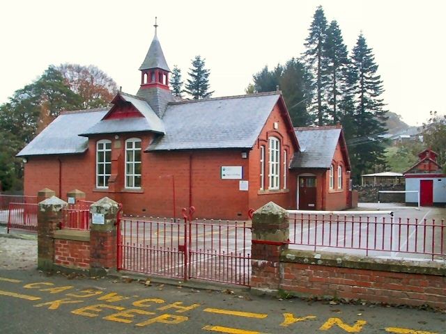
The village has a small, bilingual primary school, Ysgol Cyffylliog, which had 25 pupils in 2011.
Cyffylliog
Church of St Mary
The village church, St. Mary's, dates from the late 12th century but has been extensively renewed since that time including an almost complete rebuilding in 1876. Although the church has been arduously restored, it retains its late medieval ceiling and an unusual Georgian ‘hearse house’. The church is open by arrangement.
The village also has a Presbyterian chapel, Salem Chapel.