
Formed 24 December 2010 Damage Unknown | Dissipated 25 December 2010 Highest winds 75 km/h Fatalities 1 | |
 | ||
Lowest pressure 993 hPa (mbar); 29.32 inHg Date 24 December 2010 – 25 December 2010 | ||
Tropical cyclone tasha 04p 2010
Tropical Cyclone Tasha was a short-lived, but devastating tropical cyclone that exacerbated widespread floods in Queensland, Australia during the 2010 Christmas holiday.
Contents
- Tropical cyclone tasha 04p 2010
- Cyclone tasha christmas 2010
- Meteorological history
- Impact and aftermath
- References
Cyclone tasha christmas 2010
Meteorological history
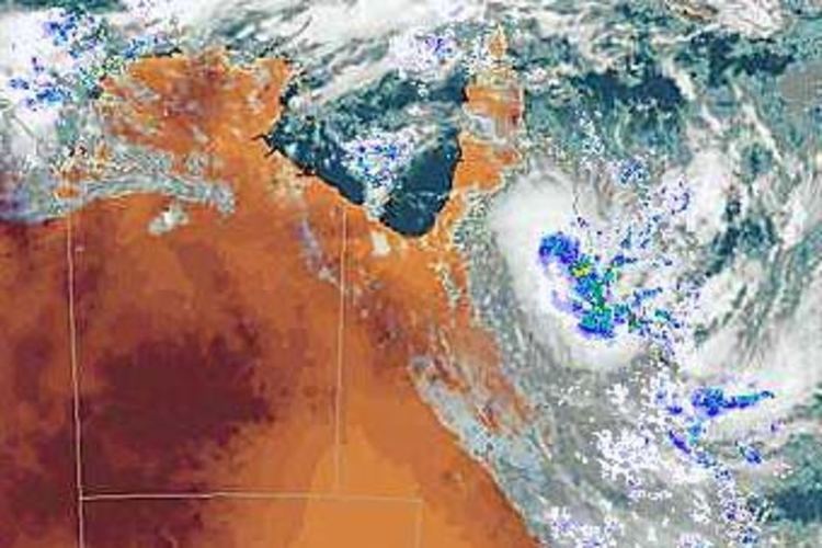
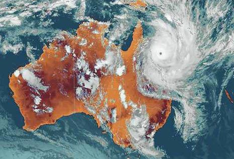
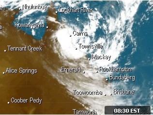
Tropical Cyclone Tasha was first identified on 24 December 2010 by the Joint Typhoon Warning Centre (JTWC) as a weak area of low pressure accompanied by increasing deep convection. At the surface, the structure of the storm's circulation was uncertain as feeder bands provided a clear indication of its centre; however, the lack of westerly winds at the surface refuted this. Situated roughly 370 kilometres (230 mi) east-northeast of Cairns, Queensland, favourable environmental conditions, such as low wind shear, would allow for further development of the low. Later on 24 December, the Australian Bureau of Meteorology (BOM) classified the system as a tropical low. Shortly thereafter, the system rapidly consolidated as deep convection formed around a well-defined low-level circulation. This prompted the JTWC to issue a Tropical Cyclone Formation Alert as they anticipated the system to intensify into a tropical cyclone within the following 24 hours. At 16:00 UTC, the BOM upgraded the low to a Category 1 cyclone, assigning with the name Tasha.
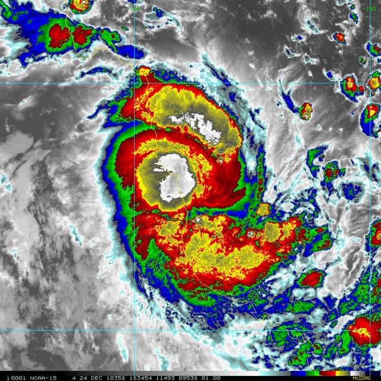
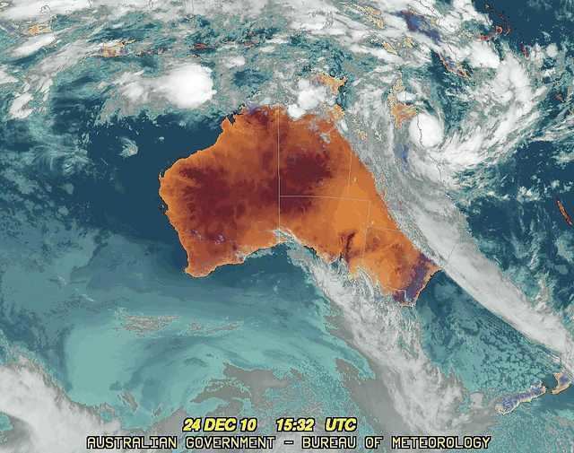
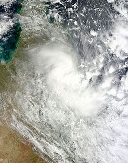
Within hours of the BoM declaring Tasha a tropical cyclone, the JTWC followed suit and issued their first advisory on the storm, designating it as Tropical Cyclone 04P. Situated along the northwestern edge of a subtropical ridge, Tasha tracked southwestward towards Queensland, Australia and intensified. The storm attained its peak intensity on 24 December with winds of 75 km/h (45 mph) and a barometric pressure of 993 mbar (hPa; 29.32 inHg). Hours later, the centre of Tasha made landfall between Cairns and Innisfail at this intensity. Later that day, the BOM issued their final advisory on Tasha as it weakened to a tropical low over Queensland; the JTWC followed suit shortly thereafter. The remnants of Tasha persisted in the region for several more days, bringing heavy rains to much of Queensland.
Impact and aftermath
Following the Bureau of Meteorology's first advice for the tropical low on 24 December, a cyclone warning was declared for areas between Port Douglas and Lucinda, Queensland. Some parts of Queensland were already suffering from flooding and additional rainfall was expected to worsen the situation.
Although a relatively weak storm, Tasha produced widespread torrential rains in Queensland, amounting to more than 250 mm (9.8 in) in some areas. Thousands of hectares of cropland were inundated by floods and many towns and cities were underwater. In Theodore, much of the area was flooded after the Dawson River reached its highest level in 50 years, cresting around 14 m (46 ft). This surpassed the previous record by more than 50 cm (1.6 ft). Efforts to evacuate the entire town of 300 were made as water levels continued to rise. Thousands of people were evacuated by local authorities using military helicopters. The town of Ingham was isolated as the Herbert River reached a level of 12.2 m (40 ft). The town of Dalby was split in two by the swollen Myall Creek, leaving more than 100 homes flooded. One fatality took place in Mareeba, near where Tasha made landfall, where a man drowned after being swept off a footbridge.
Areas as far south as Brisbane were affected by Tasha. There, roughly 1,100 emergency calls for help were made as hundreds of drivers became trapped on flooded roads. In New South Wales, 175 people were evacuated to emergency shelters as the flooding spread south. An additional 800 people were isolated in the towns of Urbenville and Bonalbo on 28 December as flood waters blocked off roads.
By 28 December, nearly half of Queensland was flooded and preliminary damage estimates exceeded A$1.4 billion. Total economic losses also reached A$6 billion, roughly 0.5% of the nation's gross domestic product. In response to the severe flooding, the Government of Queensland declared numerous towns as disaster areas, allowing for federal funds to be used. By 27 December, flood waters began to recede in Babinda and Gordonvale, leaving behind debris and thick black mud. The following day, Prime Minister Julia Gillard announced that additional Blackhawk helicopters would be sent to assist in evacuation efforts.